The Netherlands, a country in northwestern Europe, is known for a flat landscape of canals, tulip fields, windmills and cycling routes. Amsterdam, the capital, is home to the Rijksmuseum, Van Gogh Museum and the house where Jewish diarist Anne Frank hid during WWII. Canalside mansions and a trove of works from artists including Rembrandt and Vermeer remain from the city’s 17th-century “Golden Age.”
Netherlands literally means “lower countries” in reference to its low elevation and flat topography, with only about 50% of its land exceeding 1 m (3.3 ft) above sea level, and nearly 26% falling below sea level. Most of the areas below sea level, known as polders, are the result of land reclamation that began in the 14th century.Colloquially or informally the Netherlands is occasionally referred to by the pars pro toto Holland.In the Republican period, which began in 1588, the Netherlands entered a unique era of political, economic, and cultural greatness, ranked among the most powerful and influential in Europe and the world; this period is known as the Dutch Golden Age. During this time, its trading companies, the Dutch East India Company and the Dutch West India Company, established colonies and trading posts all over the world.
1.Amsterdam’s Museums
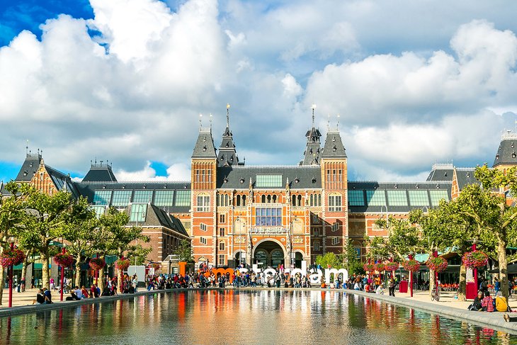
Amsterdam is known for many things, but its museums are among the top attractions in the Netherlands, and with good reason.
Arts and antiquities aficionados will appreciate the Rijksmuseum (National Museum), home to a massive collection that occupies over 250 rooms. Collections include a library, sculptures, paintings, and a variety of cultural artifacts. Art lovers will also want to visit the Rembrandt House Museum, located in the artist’s former home, as well as the remarkable Van Gogh Museum.
No visit to Amsterdam is complete without a visit to the Anne Frank House, the actual home where Anne hid from Nazis during the occupation. Visitors can see the home as it was while she wrote her diary and learn about Amsterdam’s Jewish refugees. Tourists can learn even more at The Resistance Museum (Verzetsmuseum), which explores the attempts to resist Nazi occupation. The Jewish Historical Museum is also in Amsterdam, with many religious artifacts on display.
Among Amsterdam’s other top history museums is the National Maritime Museum (Het Scheepvaartmuseum) and the Amsterdam Museum, which explores the city’s role within its own country and internationally throughout history. The NEMO Science Museum is an excellent place for families to explore, as is the Museum of the Tropics (Tropenmuseum).
2.Kinderdijk
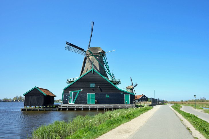
More than 1.000 old windmills still exist in the Netherlands. The largest concentration of Dutch windmills can be found near the village of Kinderdijk (“Children’s dike”). To drain the excess water from the polders, which are situated below sea-levels, 19 windmills were built around 1740. They have been well preserved to the present day and are now popular tourist attractions in the Netherlands.
Near Rotterdam, beside the River Noord, sits the village of Kinderdijk, one of the most photographed places in the Netherlands. Here, visitors will find the country’s largest collection of historic windmills, a total of 19, which were built between 1722 and 1761.
Unlike many other surviving windmills that were built to process grain and other materials, these were made as part of a water management system to keep the village from flooding. Each is a designated UNESCO World Heritage Site, and tourists can watch the huge sails spin on special “Mill Days.”
3.Hoge Veluwe
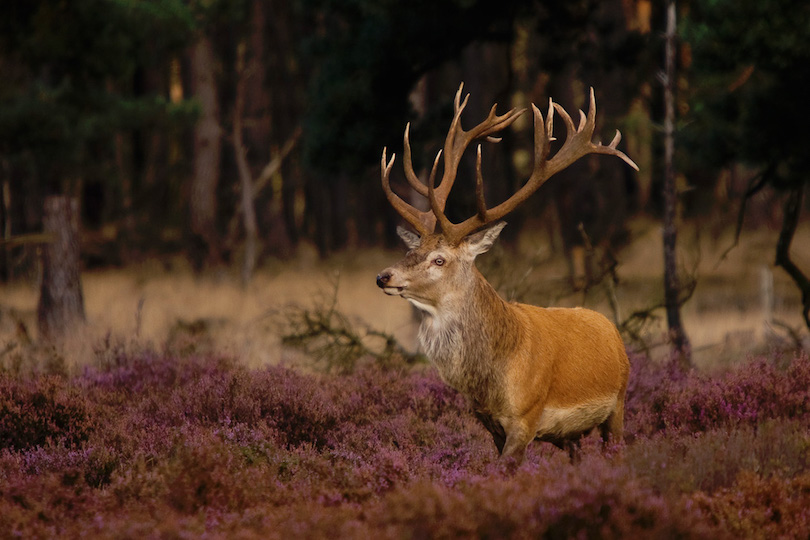
The largest nature park in the Netherlands is the Hoge Veluwe National Park, covering 13,750 acres in the center of the country, just eight kilometers from Arnheim. Originally intended as a hunting park, this privately owned nature reserve is a protected home for a wide variety of animals, including wild boar; deer; birds; and the rare mouflon, a breed of wild sheep.
The Hoge Veluwe National Park is one of the largest continuous nature reserves in the Netherlands, consisting of heathlands, sand dunes, and woodlands. The Kröller-Müller Museum with it large collection of paintings by Vincent van Gogh is located within the park. Bicycles are available for free to visitors of the Hoge Veluwe, with much of the area being inaccessible by car.Bicycles are available for free to visitors of the Hoge Veluwe, with much of the area being inaccessible by car.
4.Keukenhof Gardens
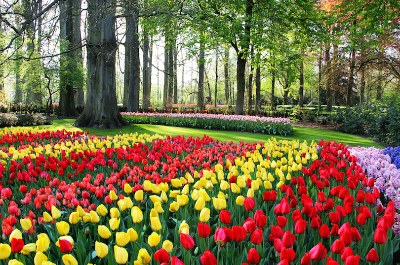
Keukenhof, also known as the Garden of Europe, is one of the world’s largest flower gardens, situated in the municipality of Lisse, in the Netherlands. According to the official website, Keukenhof Park covers an area of 32 hectares and approximately 7 million flower bulbs are planted in the gardens annually.
Keukenhof is located in the province of South Holland, south of Haarlem and southwest of Amsterdam in the area called the “Dune and Bulb Region” (Duin- en Bollenstreek). It is accessible by bus from Haarlem and Leiden train stations as well as Schiphol. Though its grounds are open year-round for private affairs and festivals, Keukenhof is only open to the general public for a world-renowned 8 week tulip display from mid-March to mid-May, with peak viewing arriving near mid-April, depending on growing season weather, which varies annually. In 2019, 1.5 million people visited Keukenhof,equivalent to 26,000 visitors per day. By comparison, the Rijksmuseum receives an average of 8,000 visitors per day, the Efteling receives 14,000.
Each autumn, 40 gardeners plant the 7 million bulbs, donated to the park by over 100 growers. Planting starts early October and is usually completed by 5 December, around Sinterklaas.The flowerbeds are synchronised to the different bulb flowerings to ensure blooms throughout the duration of park’s 8-week opening. To ensure continuous bloom, three bulbs are planted in each location. The shallowest bulb will bloom first for three weeks, followed by the subsequent layers.
In addition to the tulip gardens, Keukenhof features a variety of other gardens. The English landscape garden features winding paths and surprise see-through vistas. The walled area of the historical features archival varieties. In the Nature Garden shrubs and perennials are combined with bulb plants. The Japanese Country Garden is a non-traditional garden in a natural environment. Four pavilions house rotating displays and flower exhibits.
5.West Frisian Islands
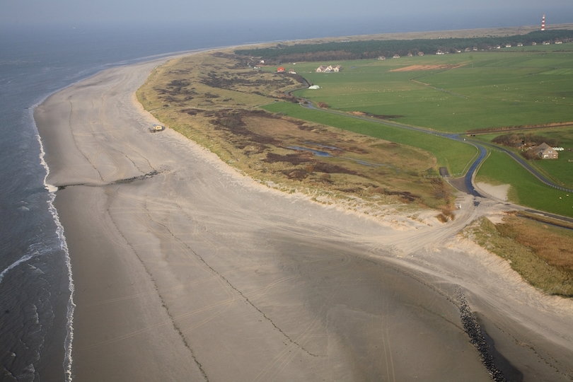
The West Frisian Islands are a chain of islands in the North Sea off the Dutch coast, along the edge of the Wadden Sea. They continue further east as the German East Frisian Islands and are part of the Frisian Islands.
The islands Noorderhaaks and Texel are part of the province of North Holland. The islands Vlieland, Richel, Griend, Terschelling, Ameland, Rif, Engelsmanplaat, and Schiermonnikoog are part of the province of Friesland. The small islands Simonszand, Rottumerplaat, Rottumeroog, and Zuiderduintjes belong to the province of Groningen.
The Frisian Islands are nowadays mostly famous as a holiday destination. Island hopping is possible by regular ferries from the mainland and by specialised tour operators. Cycling is the most favourable means of transport on most of the islands. On Vlieland and Schiermonnikoog cars are allowed only for regular inhabitants.
Under the supervision of licensed guides several islands can be reached by walking on the mudflats during low tides. On the islands cycling is the most favorable means of transport.
6.Canals of Amsterdam

Much of the Amsterdam canal system is the successful outcome of city planning. In the early part of the 17th century, with immigration rising, a comprehensive plan was put together, calling for four main, concentric half-circles of canals with their ends resting on the IJ Bay. Known as the “grachtengordel”, three of the canals are mostly for residential development (Herengracht or ‘’Patricians’ Canal’’; Keizersgracht or ‘’Emperor’s Canal’’; and Prinsengracht or ‘’Prince’s Canal’’), and a fourth, outer canal, the Singelgracht, for purposes of defense and water management. The plan also envisaged interconnecting canals along radii; a set of parallel canals in the Jordaan quarter (primarily for the transportation of goods, for example, beer); the conversion of an existing, inner perimeter canal (Singel) from a defensive purpose to residential and commercial development; and more than one hundred bridges. The defensive purpose of the Nassau/Stadhouderskade was served by moat and earthen dikes, with gates at transit points but otherwise no masonry superstructures.
Much of the Amsterdam canal system is the successful outcome of city planning. In the early part of the 17th century, with immigration rising, a comprehensive plan was put together, calling for four main, concentric half-circles of canals with their ends resting on the IJ Bay. Known as the “grachtengordel”, three of the canals are mostly for residential development (Herengracht or ‘’Patricians’ Canal’’; Keizersgracht or ‘’Emperor’s Canal’’; and Prinsengracht or ‘’Prince’s Canal’’), and a fourth, outer canal, the Singelgracht, for purposes of defense and water management.
7.Delta Project
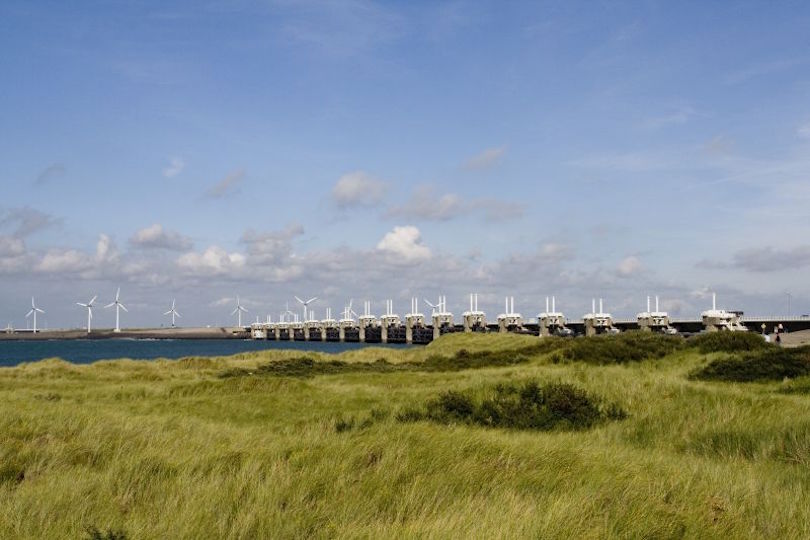
The estuaries of the rivers Rhine, Meuse and Schelde have been subject to flooding over the centuries. After building the Afsluitdijk (1927 – 1932), the Dutch started studying the damming of the Rhine-Meuse Delta. Plans were developed to shorten the coastline and turn the delta into a group of freshwater coastal lakes. By shortening the coastline, fewer dikes would have to be reinforced.
Due to indecision and the Second World War, little action was taken. In 1950 two small estuary mouths, the Brielse Gat near Brielle and the Botlek near Vlaardingen were dammed. After the North Sea flood of 1953, a Delta Works Commission was installed to research the causes and develop measures to prevent such disasters in future. They revised some of the old plans and came up with the “Deltaplan”.
The Delta Project of which the Delta Works are part of was originally designed in a period of time when environmental awareness and ecological effects of engineering projects were barely taken into consideration. Although the level of awareness for the environment grew throughout the years, the Delta Project has caused numerous irreversible[citation needed] effects on the environment in the past. Blocking the estuary mouths did reduce the length of dykes that otherwise would have to be built to protect against floods, but it also led to major changes in the water systems. For example, the tides disappeared, which resulted in a less smooth transition from sea water into fresh water. Flora and fauna suffered from this noticeable change. In addition, rivers got covered up by polluted sludge, since there was no longer an open passage to the sea.
