by Best-Mag Magazine Editorial | Travel
California is a state in the Western region of the United States. It borders Oregon to the north, Nevada and Arizona to the east, and the Mexican state of Baja California to the south; it has a coastline along the Pacific Ocean to the west. With over 38.9 million residents across a total area of approximately 163,696 square miles (423,970 km2), it is the most populous U.S. state, the third-largest U.S. state by area, and the most populated subnational entity in North America.
The Greater Los Angeles and San Francisco Bay areas in California are the nation’s second and fifth-most populous urban regions respectively. Greater Los Angeles has over 18.7 million residents and the San Francisco Bay Area has over 9.6 million residents.Los Angeles is the state’s most populous city and the nation’s second-most populous city. San Francisco is the second-most densely populated major city in the country. Los Angeles County is the country’s most populous county, and San Bernardino County is the nation’s largest county by area. Sacramento is the state’s capital city.
1.San Francisco and the Golden Gate Bridge
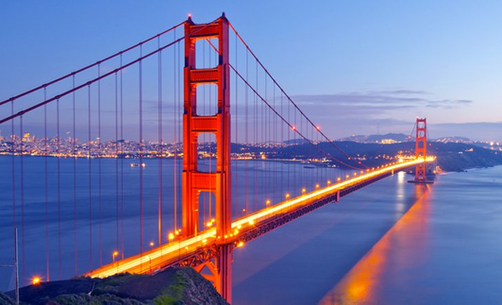
The Golden Gate Bridge is a suspension bridge spanning the Golden Gate, the one-mile-wide (1.6 km) strait connecting San Francisco Bay and the Pacific Ocean. The structure links the U.S. city of San Francisco, California—the northern tip of the San Francisco Peninsula—to Marin County, carrying both U.S. Route 101 and California State Route 1 across the strait. It also carries pedestrian and bicycle traffic, and is designated as part of U.S. Bicycle Route 95. Recognized by the American Society of Civil Engineers as one of the Wonders of the Modern World, the bridge is one of the most internationally recognized symbols of San Francisco and California.
The idea of a fixed link between San Francisco and Marin had gained increasing popularity during the late 19th century, but it was not until the early 20th century that such a link became feasible. Joseph Strauss served as chief engineer for the project, with Leon Moisseiff, Irving Morrow and Charles Ellis making significant contributions to its design. The bridge opened to the public in 1937 and has undergone various retrofits and other improvement projects in the decades since.
One of the most beautiful cities in America, San Francisco should be on everyone’s must-see list. The ocean and hills provide a stunning natural setting, but the quaint neighborhoods, historic sites, green spaces, inspiring cultural institutions, and relaxed attitude are what truly make this city special.
The iconic Golden Gate Bridge is one of the key sights and what many people call to mind when they think of the San Francisco, and even California. The orange frame against the blue water of San Francisco Bay, or rising out of the fog that often covers the area is an unforgettable sight. You can appreciate the bridge from afar or, for a more personal experience, drive over it, walk on it, or even bike across it.
2.Yosemite National Park
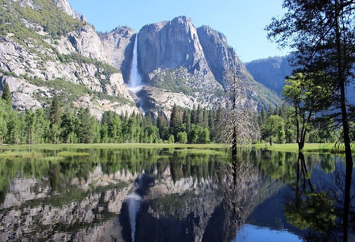
Yosemite National Parkis a national park in California.It is bordered on the southeast by Sierra National Forest and on the northwest by Stanislaus National Forest. The park is managed by the National Park Service and covers 759,620 acres (1,187 sq mi; 3,074 km2)in four counties – centered in Tuolumne and Mariposa, extending north and east to Mono and south to Madera. Designated a World Heritage Site in 1984, Yosemite is internationally recognized for its granite cliffs, waterfalls, clear streams, giant sequoia groves, lakes, mountains, meadows, glaciers, and biological diversity. Almost 95 percent of the park is designated wilderness. Yosemite is one of the largest and least fragmented habitat blocks in the Sierra Nevada.
Its geology is characterized by granite and remnants of older rock. About 10 million years ago, the Sierra Nevada was uplifted and tilted to form its unique slopes, which increased the steepness of stream and river beds, forming deep, narrow canyons. About one million years ago glaciers formed at higher elevations. They moved downslope, cutting and sculpting the U-shaped Yosemite Valley.
Yosemite National Park in Northern California is one of the United States’ most scenic and most visited national parks. The mountains, valleys, rivers, and spectacular waterfalls have drawn tourists, artists, and athletes here for decades. For nature lovers, a visit here is one of the best things to do in California.
Most of the key sights and things to do in Yosemite National Park are in Yosemite Valley. Carved by glaciers during the last ice age, the granite walls and huge waterfalls are some of the most outstanding features in the park. This is where you’ll find the big name attractions, like Yosemite Falls, Half Dome, and El Capitan.
3.Disneyland
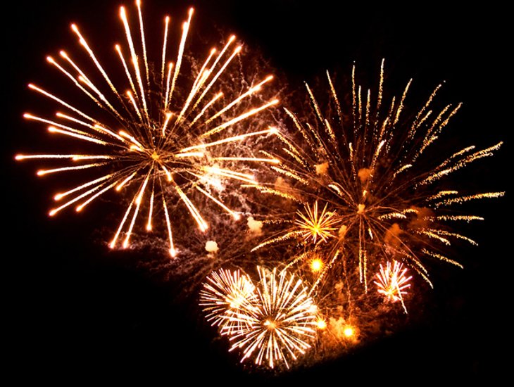
Disneyland is a theme park at the Disneyland Resort in Anaheim, California. It was the first theme park opened by The Walt Disney Company and the only one designed and constructed under the direct supervision of Walt Disney, and opened on July 17, 1955.
Disney initially envisioned building a tourist attraction adjacent to his studios in Burbank to entertain fans who wished to visit; however, he soon realized that the proposed site was too small for the ideas that he had. After hiring the Stanford Research Institute to perform a feasibility study determining an appropriate site for his project, Disney bought a 160-acre (65 ha) site near Anaheim in 1953. The park was designed by a creative team hand-picked by Walt from internal and outside talent. They founded WED Enterprises, the precursor to today’s Walt Disney Imagineering. Construction began in 1954 and the park was unveiled during a special televised press event on the ABC Television Network on July 17, 1955. Since its opening, Disneyland has undergone expansions and major renovations, including the addition of New Orleans Square in 1966, Bear Country in 1972, Mickey’s Toontown in 1993, and Star Wars: Galaxy’s Edge in 2019. Additionally, Disney California Adventure Park opened in 2001 on the site of Disneyland’s original parking lot.
Disneyland, located in Anaheim, is California’s premier family destination and one of the top family vacation destinations in the US. This massive amusement park is home to all kinds of rides, games, shows, and entertainment, complete with restaurants and hotels. The park is a combination of theme rides and recreated worlds and cultures. You can find shows and other entertainment designed for both children and adults.
Long line ups and wait times have been reduced somewhat by the invention of FastPass+, which gives you the ability to book specific ride times, a hug with a character, and entertainment events. However, when kids are out of school, either for the summer, Christmas, spring break, or any other holiday, you can be sure that the park will be very busy.
4.Death Valley National Park
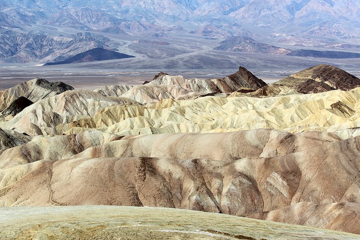
Death Valley National Park is an American national park that straddles the California–Nevada border, east of the Sierra Nevada. The park boundaries include Death Valley, the northern section of Panamint Valley, the southern section of Eureka Valley and most of Saline Valley.
The park occupies an interface zone between the arid Great Basin and Mojave deserts, protecting the northwest corner of the Mojave Desert and its diverse environment of salt-flats, sand dunes, badlands, valleys, canyons and mountains.
Death Valley is the largest national park in the contiguous United States, as well as the hottest, driest and lowest of all the national parks in the United States. It contains Badwater Basin, the second-lowest point in the Western Hemisphere and lowest in North America at 282 feet (86 m) below sea level. More than 93% of the park is a designated wilderness area.
Death Valley National Park contains some of California’s most inhospitable terrain, with extreme heat that has left this desert area strangely beautiful. Salt fields, dry parched land, sand dunes, mountains, unique rock formations, and a lake that lies below sea level create a unique landscape in this remote valley.
Some of the easiest to reach highlights in Death Valley are the sand dunes near Stove Pipe Wells, Badwater Basin, Zabriskie Point, and Dantes View. These and others are all easy to reach with a regular vehicle. If you have a 4WD vehicle, you can head out to more remote places like The Race Track.
5.Big Sur
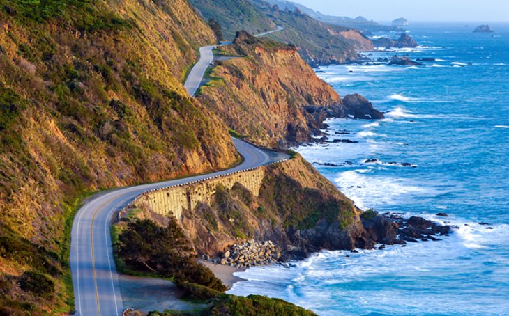
Big Sur (/ˈsɜːr/) is a rugged and mountainous section of the Central Coast of the U.S. state of California, between Carmel Highlands and San Simeon, where the Santa Lucia Mountains rise abruptly from the Pacific Ocean. It is frequently praised for its dramatic scenery. Big Sur has been called the “longest and most scenic stretch of undeveloped coastline in the contiguous United States”, a sublime “national treasure that demands extraordinary procedures to protect it from development”, and “one of the most beautiful coastlines anywhere in the world, an isolated stretch of road, mythic in reputation”. The views, redwood forests, hiking, beaches, and other recreational opportunities have made Big Sur a popular destination for visitors from across the world. With 4.5 to 7 million visitors annually, it is among the top tourist destinations in the United States, comparable to Yosemite National Park, but with considerably fewer services, and less parking, roads, and related infrastructure.
This beautiful stretch along the Central Coast of California offers a chance to get back to nature. Camping and hiking at Garrapata State Park and Pfeiffer Big Sur State Park are some of the best places for these pursuits.
Big Sur begins about four miles south of Carmel in Yankee Point and stretches along the Highway No. 1 as far as Salmon Cove, some 17 miles north of San Simeon. This scenic road offers splendid views over the picturesque coastline. To the east stretches a true wilderness – the Santa Lucia Mountains and Ventana Forests, with more than 220 miles of trails.
Pfeiffer Big Sur State Park is a great place for hikers, sunbathers, and those looking for a nature escape. The park has camping facilities and, for anyone looking for a little more comfort, the Big Sur Lodge offers a peaceful retreat in a superb location. One of the highlights in the park is Pfeiffer Falls, which is reached by the Valley View Trail. A branch off this trail leads to the Valley Overlook with views that extend to the ocean and the Big Sur River Valley.
6.Lake Tahoe

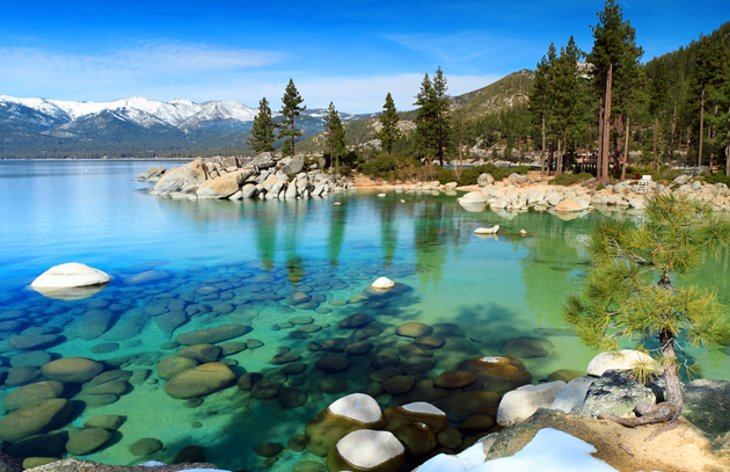
Lake Tahoe (/ˈtɑːhoʊ/; Washo: Dáʔaw) is a freshwater lake in the Sierra Nevada of the Western United States, straddling the border between California and Nevada. Lying at 6,225 ft (1,897 m) above sea level, Lake Tahoe is the largest alpine lake in North America. and at 122,160,280 acre⋅ft (150.7 km3) it trails only the five Great Lakes as the largest by volume in the United States. Its depth is 1,645 ft (501 m), making it the second deepest in the United States after Crater Lake in Oregon (1,949 ft or 594 m).
The lake was formed about two million years ago as part of the Lake Tahoe Basin, and its modern extent was shaped during the ice ages. It is known for the clarity of its water and the panorama of surrounding mountains on all sides. The area surrounding the lake is also referred to as Lake Tahoe, or simply Tahoe; its English name is derived from its Washo name, Dáʔaw. More than 75% of the lake’s watershed is national forest land, covered by the Lake Tahoe Basin Management Unit of the United States Forest Service.
Lake Tahoe is a major tourist attraction in both Nevada and California. It is home to winter sports, summer outdoor recreation, and scenery enjoyed throughout the year. Snow and ski resorts are a significant part of the area’s economy and reputation. The Nevada side also offers several lakeside casino resorts, with highways providing year-round access to the entire area.
Stunning Lake Tahoe lies high in the Sierra Nevada mountain range and is a popular year-round vacation destination in California. Lake Tahoe is about more than just the lake, it’s the forests and mountains, small towns, and multitude of activities the area offers.
The blue lake, with its turquoise coves and surrounding mountains, is a summer playground for boaters, beach goers, campers, and nature lovers. The beautiful beaches and shallow coves are some of the main draws for families visiting the area in summer. Places like D.H. Bliss State Park and Kings Beach State Recreation Area are popular beaching destinations around Lake Tahoe.
7.Sequoia and Kings Canyon National Parks
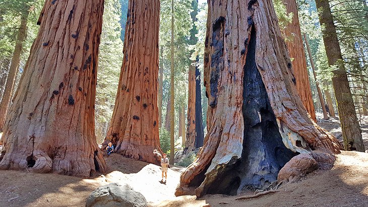
Sequoia National Park is an American national park in the southern Sierra Nevada east of Visalia, California. The park was established on September 25, 1890, and today protects 404,064 acres (631 sq mi; 163,519 ha; 1,635 km2)[2] of forested mountainous terrain. Encompassing a vertical relief of nearly 13,000 feet (4,000 m), the park contains the highest point in the contiguous United States, Mount Whitney, at 14,505 feet (4,421 m) above sea level. The park is south of, and contiguous with, Kings Canyon National Park; both parks are administered by the National Park Service together as Sequoia and Kings Canyon National Parks. UNESCO designated the areas as Sequoia-Kings Canyon Biosphere Reserve in 1976.
The park is notable for its giant sequoia trees, including the General Sherman tree, the largest tree on Earth by volume. The General Sherman tree grows in the Giant Forest, which contains five of the ten largest trees in the world. The Giant Forest is connected by the Generals Highway to Kings Canyon National Park’s General Grant Grove, home of the General Grant tree among other giant sequoias. The park’s giant sequoia forests are part of 202,430 acres (316 sq mi; 81,921 ha; 819 km2) of old-growth forests shared by Sequoia and Kings Canyon National Parks. The parks preserve a landscape that was first cultivated by the Monache tribe, the southern Sierra Nevada before Euro-American settlement.Home to the largest trees on Earth, Sequoia and Kings Canyon National Parks are bucket-list destinations. The sequoias here are the largest living things in the world, and many of them are more than 2,000 years old, with some even more than 3,000 years old.
These adjacent parks cover an area of mountains with majestic granite peaks, deep gorges, lakes, rivers, and forests, but they are quite different from each other. If you are planning on visiting both parks, you will need at least a couple of days.
Although both parks are home to the giant sequoias, Sequoia National Park is arguably the best place to visit these ancient wonders. Easy walking trails, many of them paved, meander through the trees and provide easy access to the major sites. This park is also home to Mt. Whitney, which at 14,495 feet is the highest mountain in the US (apart from Alaska).
You can find some beautiful campgrounds in Sequoia National Park, many of which are well positioned for visiting the trees and other attractions, like Moro Rock, and the famous giant sequoia known as General Sherman Tree.
by Best-Mag Magazine Editorial | Travel
Bucharest is the capital and largest city of Romania. It is described as the cultural, financial, entertainment, and media centre in the country with a significant influence in Eastern Europe as well. In geopolitical regards, Bucharest has been and still is an important capital of a state situated in Central and Eastern Europe, where noteworthy summits had taken place (for example the 2008 Bucharest summit). It is also a city with a significant influence in terms of education, tourism, research, technology, health care, art, fashion, sports, and politics. Bucharest is a major economic center in Romania, with a diverse and growing economy that includes industries such as IT, finance, and manufacturing. The city has also seen significant investment in infrastructure, with new roads, bridges, and public transportation systems being built to improve connectivity and mobility. It is located in the south-east of Romania, on the banks of the Dâmbovița river, less than 60 km (37.3 mi) north of the Danube River and the border with Bulgaria. It is also one of the most populated cities of the European Union (EU) within city limits and the most populated capital in Eastern Europe. It was the capital of Wallachia from 1659 to 1859 and the capital of the United Principalities of Moldavia and Wallachia (Romanian United Principalities, later the Kingdom of Romania) from 1859 to 1881.
1.Palace of the Parliament
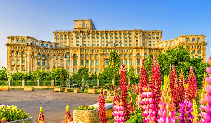
The Palace of the Parliament (Romanian: Palatul Parlamentului), also known as the House of the Republic or People’s House/People’s Palace , is the seat of the Parliament of Romania, located atop Dealul Spirii in Bucharest, the national capital. The Palace reaches a height of 84 m (276 ft), has a floor area of 365,000 m2 (3,930,000 sq ft) and a volume of 2,550,000 m3 (90,000,000 cu ft). The Palace of the Parliament is one of the heaviest buildings in the world, weighing about 4,098,500,000 kilograms (9.04 billion pounds; 4.10 million tonnes), also being the second largest administrative building in the world. (The Great Pyramid of Giza at about 5.75 million tons is about 40% heavier.) The building was designed and supervised by chief architect Anca Petrescu, with a team of approximately 700 architects, and constructed over a period of 13 years (1984–97) in modernist Neoclassical architectural forms and styles, with socialist realism in mind. The Palace was ordered by Nicolae Ceaușescu (1918–1989), the president of Communist Romania and the second of two long-ruling heads of state in the country since World War II, during a period in which the personality cult of political worship and adoration increased considerably for him and his family.
The Palace of the Parliament (Palatul Parlamentului) is one of the top tourist attractions in Bucharest. It is the world’s second-largest administrative building (after the Pentagon), an architectural colossus that also claims the title as the heaviest building in the world.
Boasting more than 3,000 rooms over 330,000 square meters and constructed with marble and steel, it was originally called the People’s House by its visionary, the dictator Nicolae Ceausescu, who used it as his family’s residence and as the seat of his government.
To complete it, Ceausescu razed places of worship, workshops, factories, parks, part of the Old Town, and entire neighborhoods. More than 20,000 workers and 700 architects worked on the opulent Neoclassical-style palace over a span of 13 years, from 1985 to 1997, during which time the majority of Romanians faced poverty.
2.Romanian Athenaeum
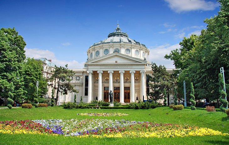
The Romanian Athenaeum (Romanian: Ateneul Român) is a concert hall in the center of Bucharest, Romania, and a landmark of the Romanian capital city. Opened in 1888, the ornate, domed, circular building is the city’s most prestigious concert hall and home of the “George Enescu” Philharmonic and of the George Enescu Festival.
. The 19th-century building, designed by French architect Albert Galleron, resembles an ancient Greek temple with a 41-meter-high dome and a peristyle of six Ionic columns.
The interiors feature a lobby of intricately painted gold-leaf ceilings, cascading balconies, and spiral marbled staircases. The 652-seat auditorium is known for its excellent acoustics and its fine art. A 70-meter-long and three-meter-high fresco that winds its way around the circular hall proudly depicts scenes from Romania’s history.
In 1865, cultural and scientific personalities such as Constantin Esarcu, V. A. Urechia, and Nicolae Creţulescu founded the Romanian Athenaeum Cultural Society. To serve its purposes, the Romanian Athenaeum, a building dedicated to art and science, would be erected in Bucharest.
The building was designed by the French architect Albert Galleron, built on a property that had belonged to the Văcărescu family and inaugurated in 1888, although work continued until 1897. A portion of the construction funds was raised by public subscription in a 28-year-long effort, of which the slogan is still remembered today: “Donate one leu for the Ateneu!”
3.Stavropoleos Church
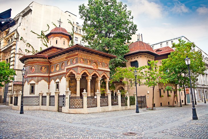
Stavropoleos Monastery (Romanian: Mănăstirea Stavropoleos), also known as Stavropoleos Church (Romanian: Biserica Stavropoleos) during the last century when the monastery was dissolved, is an Eastern Orthodox monastery for nuns in central Bucharest, Romania. Its church is built in Brâncovenesc style. The patrons of the church (the saints to whom the church is dedicated) are St. Archangels Michael and Gabriel. The name Stavropoleos is the genitive case of Stavropolis (Greek, “The city of the Cross”). One of the monastery’s constant interests is Byzantine music, expressed through its choir and the largest collection of Byzantine music books in Romania.
Tiny, peaceful, and beautiful, the Stavropoleos Church (Manastirea Stavropoleos) was built in 1724 by a Greek monk, Ioanikie Stratonikeas. With its intricately carved entrance lined with columns, this Brâncovenesc-style church stands apart as a unique landmark in Bucharest.
The Orthodox church features fine stone and wood carvings and a combination of Romanian and Byzantine elements. It is surrounded by a garden courtyard filled with 18th-century tombstones.
Inside, several frescoes and wood icons can be admired. The church complex once included an inn and a monastery but both were destroyed. The church itself was restored several times after damage from earthquakes, and is noted for its unique library that houses a large collection of books related to Byzantine music.
4.Revolution Square
Plaza de la Revolución (Spanish pronunciation: [ˈplasa ðe la reβoluˈsjon]), “Revolution Square”, is a municipality (or borough) and a square in Havana, Cuba.
The municipality, one of the 15 forming the city, stretches from the square down to the sea at the Malecón and includes the Vedado district.
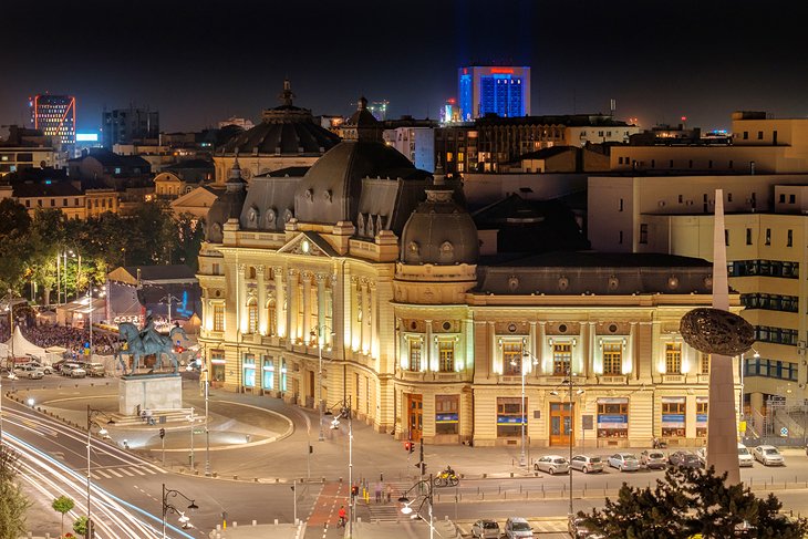
Revolution Square (Piata Revolutiei) earned its name after setting the scene of dictator Nicolae Ceausescu’s final minutes of power in Romania. On December 21, 1989, a coup d’état ensued here with the help of a crowd of more than 100,000, forcing the leader of the communist party to flee and changing the course of the country’s history.
Until that date, the central square was known as Palace Square, due to its proximity to the Royal Palace, which is the current home to the National Museum of Art.
5.Arcul de Triumf
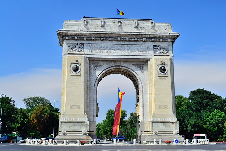
Arcul de Triumf este un monument situat în partea de nord a Bucureștiului, în sectorul 1, la intersecția șoselei Kiseleff cu bulevardele Constantin Prezan, Alexandru Averescu și Alexandru Constantinescu. Monumentul, proiectat de Petre Antonescu, a fost construit în perioada 1921-1922, renovat în perioada 1935-1936, și din nou renovat începând din 2014. El comemorează participarea României în Primul Război Mondial.
Arcul de Triumf are 27 m înălțime, cu o singură deschidere și este de formă paralelipipedică. Machetele au fost executate de artiști plastici, iar pentru cioplirea marmurei de Rușchița, pe lângă sculptorii autohtoni, s-a apelat și la un număr de zece sculptori din Italia.
Finished in 1878, Bucharest’s first Arch of Triumph (Arcul de Triumf) was made from wood and dedicated to the Romanian soldiers who fought in World War I. In 1936, it was reconstructed in granite and designed by architect Petre Antonescu at a height of 27 meters. The arch is adorned with sculptures created by the most notable Romanian sculptors, including Ion Jalea and Dimitrie Paciurea.
To this day it continues to serve its purpose of being the central point for military parades. Romanian soldiers march beneath it for big events, including each December 1st, which is the country’s national holiday.
6.National Museum of Art of Romania
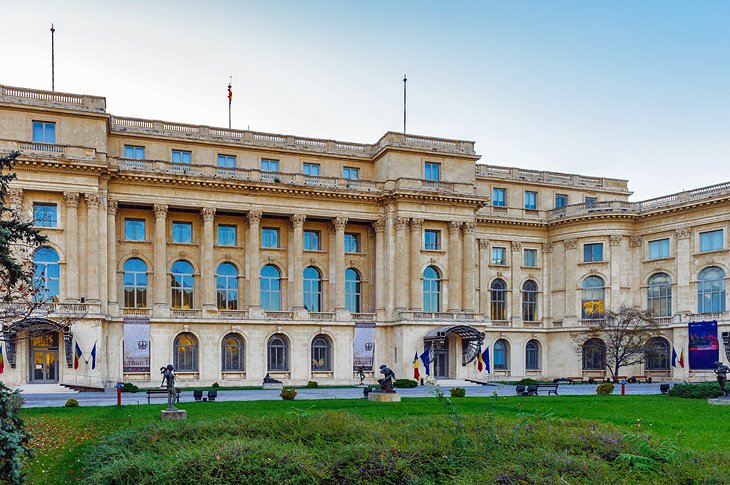
The National Museum of Art of Romania (Romanian: Muzeul Național de Artă al României) is located in the Royal Palace in Revolution Square, central Bucharest. It features collections of medieval and modern Romanian art, as well as the international collection assembled by the Romanian royal family.
The exhibition “Shadows and Light” ran from 15 July to 2 October 2005. With four centuries of French art, it was the largest exhibition of French painting in Central and Eastern Europe since 1945. 77 works were exhibited, including masterpieces by painters such as Poussin, Chardin, Ingres, David, Delacroix, Corot, Cézanne, Matisse, Picasso, and Braque.
Housed in the former Royal Palace, the National Museum of Art of Romania (Muzeul National de Arta al României) is the country’s leading art museum and houses the world’s most complete collection of Romanian art, including medieval and modern art.
Established in 1948, the museum is also where the Royal Collection, including Romanian and European art dating back to the 15th century, can be admired. More than 100,000 works are in the various halls, including paintings by the country’s most celebrated artists, Theodor Aman, Nicolae Grigorescu, and Gheorghe Tattarescu.
7.Dimitrie Gusti National Village Museum

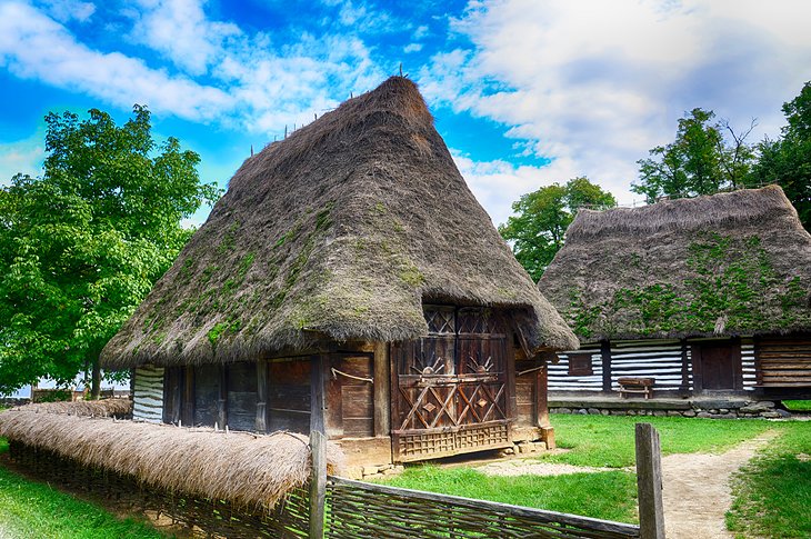
The Village Museum or formally National Museum of the Village “Dimitrie Gusti” (Romanian: Muzeul Național al Satului “Dimitrie Gusti”) is an open-air ethnographic museum located in the King Michael I Park, Bucharest, Romania. The museum showcases traditional Romanian village life. The museum extends to over 100,000 m2,and contains 123 authentic peasant settlements, 363 monuments and over 50,000 artefacts from around Romania Structures in the museum ranged from the 17th to the 20th century, representative of different ethnographic regions including Banat, Transylvania, Moldavia, Maramures, Oltenia, Dobrogea, Muntenia
Founded in 1936, the Dimitrie Gusti National Village Museum – usually shortened to simply the “Village Museum” (Muzeul Satului) – is a unique open-air
museum that stretches through leafy Herastrau Park and depicts the traditional way of life in Romania.
Visitors can wander through 300 traditional buildings, including peasant homes with steep roofs, thatched barns, heavy log cabins, various types of churches, workshops, and mills – all of which have been transported from towns across every region of Romania.
by Best-Mag Magazine Editorial | Travel
Athens romanized: Athína, pronounced Ancient Greek: Ἀθῆναι, romanized: Athênai, pronounced is a major coastal urban area in the Mediterranean, and it is both the capital and the largest city of Greece. With its urban area’s population numbering over five million, it is also the fifth largest urban area in the European Union. Athens dominates and is the capital of the Attica region and is one of the world’s oldest cities, with its recorded history spanning over 3,400 years,and its earliest human presence beginning somewhere between the 11th and 7th millennia BC. The city was named after Athena, the ancient Greek goddess of wisdom.
Classical Athens was one of the most powerful city-states in ancient Greece. It was a centre for democracy, the arts, education and philosophy, and was highly influential throughout the European continent, particularly in Ancient Rome. For this reason, it is often regarded as the cradle of Western civilization and the birthplace of democracy in its own right independently from the rest of Greece.In modern times, Athens is a huge cosmopolitan metropolis and central to economic, financial, industrial, maritime, political and cultural life in Greece. In 2023, Athens metropolitan area and its surrounding municipalities (consisting the regional area of Attica) has a population of approximately 4.0 million.
1.Acropolis of Athens
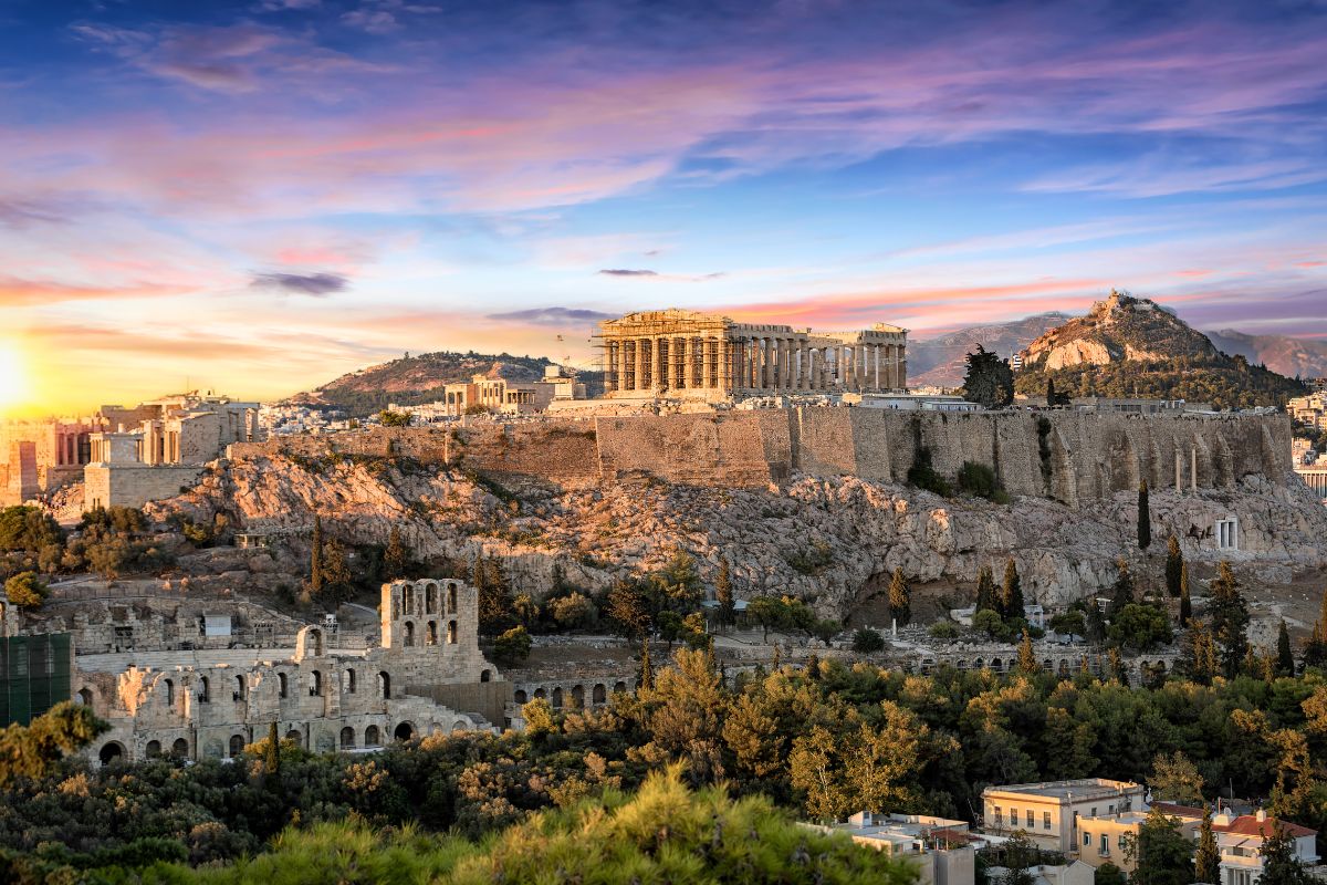
The Acropolis of Athens is an ancient citadel located on a rocky outcrop above the city of Athens, Greece, and contains the remains of several ancient buildings of great architectural and historical significance, the most famous being the Parthenon. The word Acropolis is from the Greek words ἄκρον (akron, “highest point, extremity”) and πόλις (polis, “city”). The term acropolis is generic and there are many other acropoleis in Greece. During ancient times the Acropolis of Athens was also more properly known as Cecropia, after the legendary serpent-man Cecrops, the supposed first Athenian king.
Make your way to the impressive Acropolis of Athens, the high hill centrally located in Athens that was built for religious and military reasons.On top of the Acropolis, which means “high city” is the beautiful Parthenon, and a few other historical temples and buildings including the Erechtheion, the Temple of Athena Nike, and Propylaea. Catch a glimpse of ancient Greece through the historic temples on top of the Acropolis, as you take in the recent renovations of the temples.A monument so grand, with equally stunning views of the city and sea, the lines can get extremely long. To avoid extra time waiting in line, score your Acropolis skip-the-line-tickets.
2.Parthenon
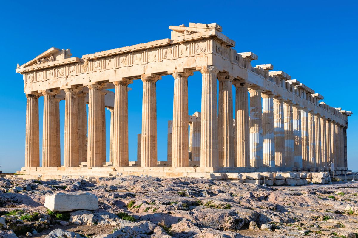
The Parthenon Greek: Παρθενώνας, romanized: Parthenónas [parθeˈnonas]) is a former temple on the Athenian Acropolis, Greece, that was dedicated to the goddess Athena during the fifth century BC. Its decorative sculptures are considered some of the high points of classical Greek art, an enduring symbol of Ancient Greece, democracy and Western civilization.
The Parthenon was built in thanksgiving for the Hellenic victory over Persian Empire invaders during the Greco-Persian Wars. Like most Greek temples, the Parthenon also served as the city treasury.
Construction started in 447 BC when the Delian League was at the peak of its power. It was completed in 438 BC; work on the decoration continued until 432 BC. For a time, it served as the treasury of the Delian League, which later became the Athenian Empire. In the final decade of the 6th century AD, the Parthenon was converted into a Christian church dedicated to the Virgin Mary. After the Ottoman conquest in the mid-fifteenth century, it became a mosque. In the Morean War, a Venetian bomb landed on the Parthenon, which the Ottomans had used as a munitions dump, during the 1687 siege of the Acropolis. The resulting explosion severely damaged the Parthenon. From 1800 to 1803, the 7th Earl of Elgin took down some of the surviving sculptures, now known as the Elgin Marbles or simply Greek Marbles, which, although he had the permission of the then Ottoman government, has subsequently become controversial.
On the beautiful Acropolis is the stunning Parthenon, the emblematic building atop the Acropolis.
Built to honor the Goddess Athena, after which the city was named, the Parthenon is said to date back to 447 BC! The Parthenon is not only a historical building, but also a symbol of democracy, the Western World, ancient Greece, and an example of classical Greek art.
The Parthenon was also built in celebration of the Hellenic victory over the Persian Empire during the Greco-Persian Wars. Throughout time, the Parthenon experienced multiple attacks and changes, one of those was being transformed into a mosque in 1458 under Muslim rule.
3.Erechtheion
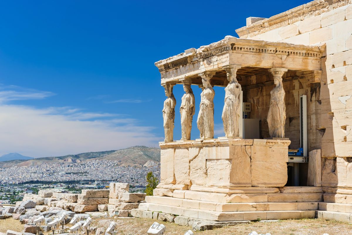
The Erechtheion latinized as Erechtheum Ancient Greek: Ἐρέχθειον, Greek: Ερέχθειο) or Temple of Athena Polias is an ancient Greek Ionic temple on the north side of the Acropolis, Athens, which was primarily dedicated to the goddess Athena.
The Ionic building, made to house the statue of Athena Polias, has in modern scholarship been called the Erechtheion (the sanctuary of Erechtheus or Poseidon) in the belief that it encompassed two buildings mentioned by the Greek-Roman geographer Pausanias: the Temple of Athena Polias and the Erechtheion. However, whether the Erechtheion referred to by Pausanias and other sources is indeed the Ionic temple or an entirely different building has become a point of contention in recent decades, with various scholars ruling out that Athena and Erechtheus were worshipped in a single building. Alternative suggested locations of the true Erechtheion include the structures on the Acropolis conventionally identified as the Arrephorion, the Sanctuary of Zeus Polieus, the Sanctuary of Pandion, and the Dörpfeld foundations. However, while there is no consensus among scholars on this issue, the building continues to be referred to as the Erechtheion by convention.
While you’re exploring the Acropolis, direct your attention to the Erechtheion, another temple dedicated to the Goddess Athena, and one of the other most photographed temples beside the Parthenon.
Beautifully decorated with statues on its southern side on what is called the Porch of the Maidens, the temple was said to have been also used as a Byzantine church, as a palace during the Frankish period, and more!
4.Acropolis Museum
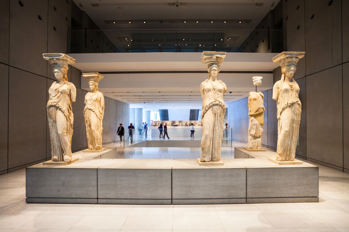
The Acropolis Museum (Greek: Μουσείο Ακρόπολης, Mouseio Akropolis) is an archaeological museum focused on the findings of the archaeological site of the Acropolis of Athens. The museum was built to house every artifact found on the rock and on the surrounding slopes, from the Greek Bronze Age to Roman and Byzantine Greece. The Acropolis Museum also lies over the ruins of part of Roman and early Byzantine Athens.
The museum was founded in 2003 while the Organization of the Museum was established in 2008. It opened to the public on 20 June 2009. More than 4,250 objects are exhibited over an area of 14,000 square metres.
Take a deep journey through Athenian history at the Acropolis Museum, taking a glimpse at some of the collections of items found during excavations and archaeological sites on the Acropolis, and its surroundings.
Admire the details of the West pediment and West frieze of the Parthenon, check out the Gallery of the Acropolis Slopes, which looks into the artifacts discovered around the Acropolis slopes, and learn about the makeup of the rock itself. Walk over some of the glass panels to discover some of the archaeological excavations underneath you!
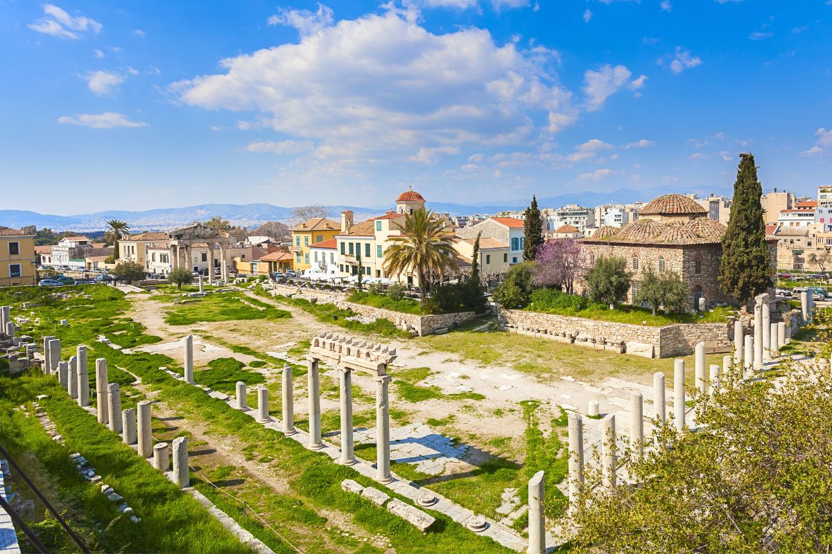
5.Ancient Agora

The ancient Agora of Athens (also called the Classical Agora) is the best-known example of an ancient Greek agora, located to the northwest of the Acropolis and bounded on the south by the hill of the Areopagus and on the west by the hill known as the Agoraios Kolonos, also called Market Hill. The Agora’s initial use was for a commercial, assembly, or residential gathering place.
A historic meeting place for the city council, the president of the council, and local people, the Ancient Agora was one of the first sites to witness examples of democracy.
Located northwest of the Acropolis, in the historic center of Athens, the Ancient Agora is a protected site that you can still see and admire, while learning about some of the other events that took place within its walls, from philosophy discussions and other important discourse.
6.Temple of Hephaestus
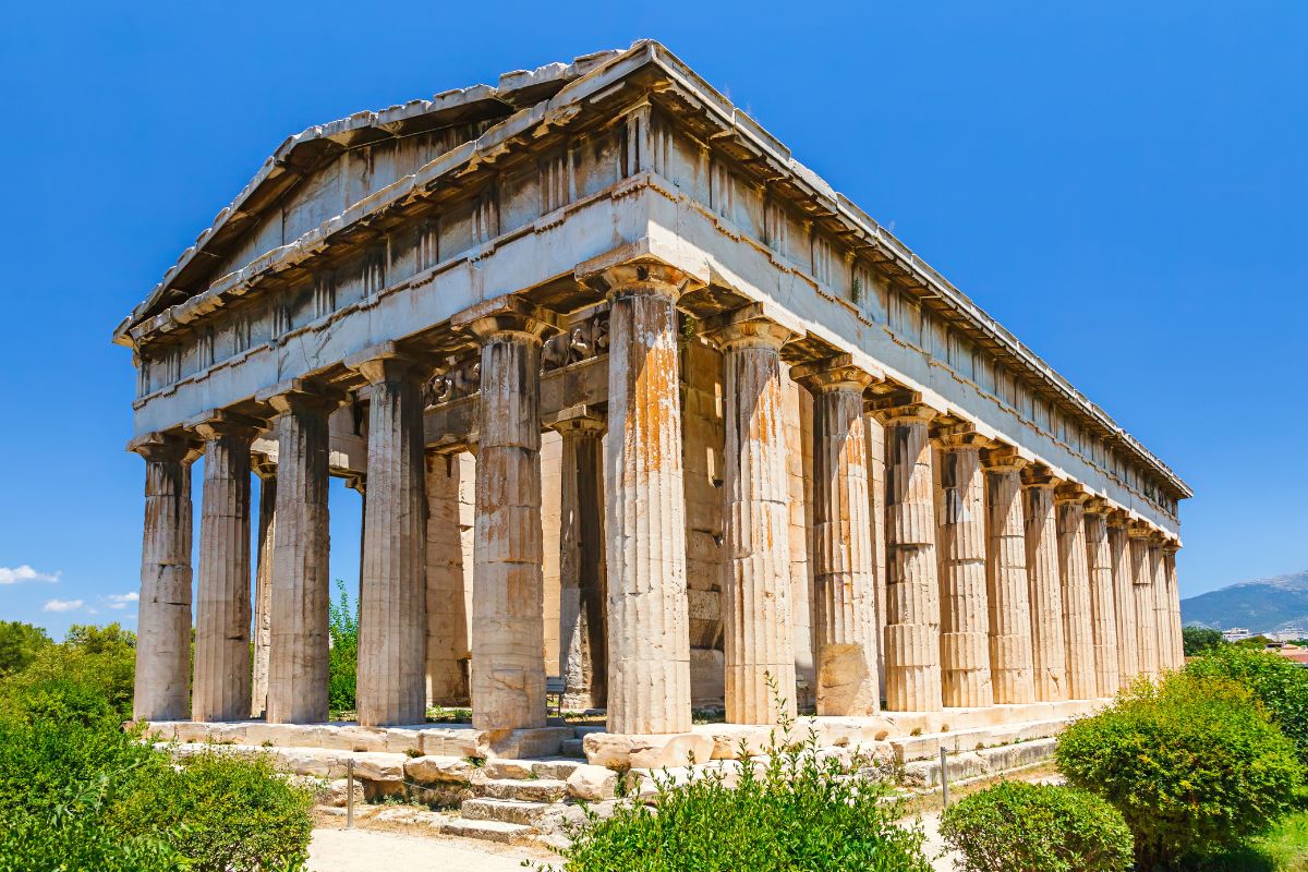
The Temple of Hephaestus or Hephaisteion (also “Hephesteum” or “Hephaesteum”; Ancient Greek: Ἡφαιστεῖον, Greek: Ναός Ηφαίστου, and formerly called in error the Theseion or “Theseum”; Ancient Greek: Θησεῖον, Greek: Θησείο), is a well-preserved Greek temple dedicated to Hephaestus; it remains standing largely intact today. It is a Doric peripteral temple, and is located at the north-west side of the Agora of Athens, on top of the Agoraios Kolonos hill. From the 7th century until 1834, it served as the Greek Orthodox church of Saint George Akamates. The building’s condition has been maintained due to its history of varied use.
When you’re strolling the Ancient Agora, you’ll notice the incredibly well-preserved Doric-style Temple of Hephaestus.
Hephaestus was known as the god of fire, and it’s said that his and Athena’s sculptures were inside the temple. Dating back to the 5th century, the Temple of Hephaestus forms part of the Golden Age of Athens.
7.National Archaeological Museum
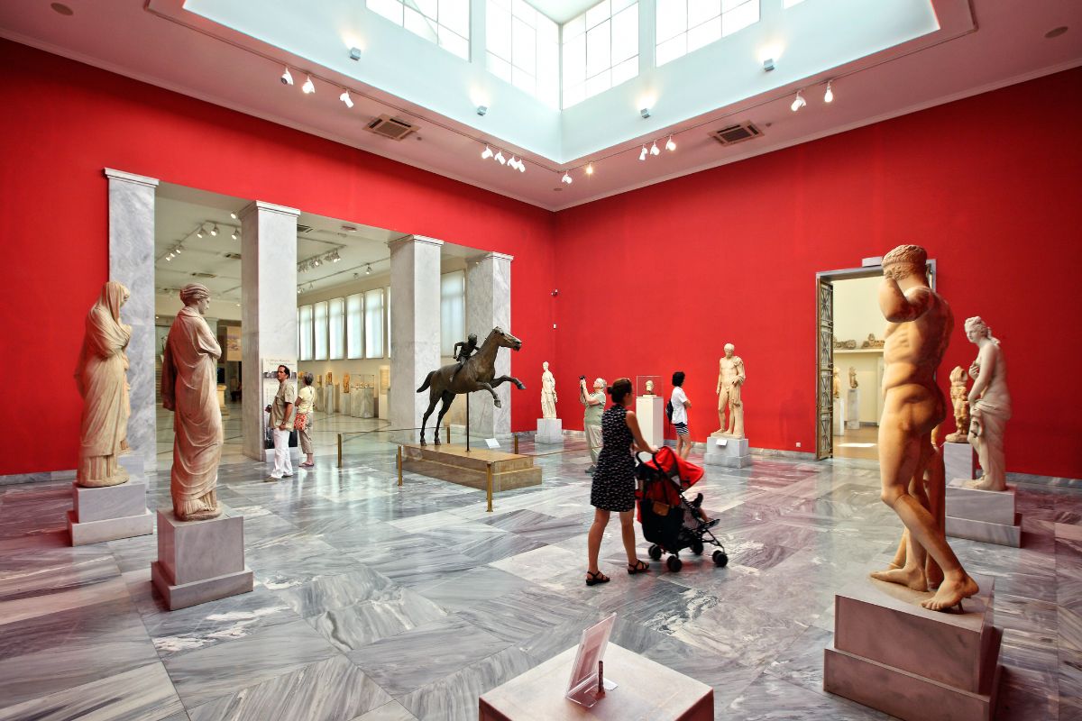
The National Archaeological Museum (Greek: Εθνικό Αρχαιολογικό Μουσείο, romanized: Ethnikó Archaiologikó Mouseío) in Athens houses some of the most important artifacts from a variety of archaeological locations around Greece from prehistory to late antiquity. It is considered one of the greatest museums in the world and contains the richest collection of Greek Antiquity artifacts worldwide.It is situated in the Exarcheia area in central Athens between Epirus Street, Bouboulinas Street and Tositsas Street while its entrance is on the Patission Street adjacent to the historical building of the Athens Polytechnic university.
Check out the wealth of archaeological information inside the National Archaeological Museum, known as the largest museum of its kind in Greece.
Dig through (pun intended) the museum’s collections and exhibits, covering everything from pieces of the Mycenaen civilization originating in the Bronze Age of ancient Greece, and a few neolithic items, to a browse through the largest sculpture collections in the world, and various pieces of metalwork.
by Best-Mag Magazine Editorial | Travel
Warsaw, officially the Capital City of Warsaw, is the capital and largest city of Poland. The metropolis stands on the River Vistula in east-central Poland. Its population is officially estimated at 1.86 million residents within a greater metropolitan area of 3.1 million residents, which makes Warsaw the 6th most-populous city in the European Union. The city area measures 517 km2 (200 sq mi) and comprises 18 districts, while the metropolitan area covers 6,100 km2 (2,355 sq mi). Warsaw is an “Alpha-” global city, a major cultural, political and economic hub, and the country’s seat of government. It is also capital of the Masovian Voivodeship.
Warsaw traces its origins to a small fishing town in Masovia. The city rose to prominence in the late 16th century, when Sigismund III decided to move the Polish capital and his royal court from Kraków. Warsaw served as the de facto capital of the Polish–Lithuanian Commonwealth until 1795, and subsequently as the seat of Napoleon’s Duchy of Warsaw. The 19th century and its Industrial Revolution brought a demographic boom which made it one of the largest and most densely populated cities in Europe. Known then for its elegant architecture and boulevards, Warsaw was bombed and besieged at the start of World War II in 1939.Much of the historic city was destroyed and its diverse population decimated by the Ghetto Uprising in 1943, the general Warsaw Uprising in 1944 and systematic razing.
1.Krakowskie Przedmiescie
Przedmieścia przy Bramie Krakowskiej zaczęły się tworzyć już w XIV w., natomiast przy nich w 1454 powstał kościół bernardynów. Wówczas teren przed murami zaczęto nazywać placem Bernardyńskim (dziś tak nazywa się plac na Czerniakowie). Drewniane domostwa budowali tutaj różnorodni rzemieślnicy, powstały cegielnie, ukształtowały się dwie odnogi placu, gdzie wschodnia prowadziła do najstarszej warszawskiej jurydyki należącej do proboszcza kolegiaty: Dziekanki. Tak zwany plac Bernardyński (lub Bernardyńskie Przedmieście) był wcześniej nazywany Czerskim Przedmieściem, a potem Krakowskim Przedmieściem, gdyż był początkiem traktu łączącego Warszawę pierwotnie z Czerskiem, a następnie z Krakowem[3]. Droga ta stała się też świetnym miejscem do budowy reprezentacyjnych pałaców magnaterii oraz rodziny królewskiej, było też znakomitym miejscem triumfalnych wjazdów do miasta (między innymi wjeżdżali tędy hetman Stefan Czarniecki czy Jan III Sobieski) oraz hołdów składanych przez Prusy Książęce i Inflanty. W I połowie XVII w. przybrała formę traktu od Kaplicy Moskiewskiej, będącej panteonem chwały oręża polskiego i tryumfów militarnych króla Zygmunta III Wazy do projektowanego „Forum Wazów”, z którego została zrealizowana jedynie kolumna króla Zygmunta.
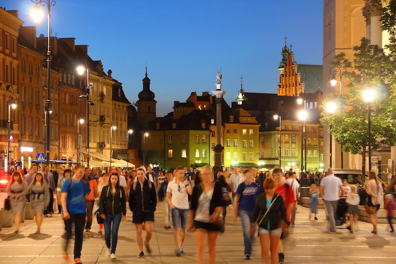
A walk down Krakowskie Przedmiescie is a great way to experience Warsaw’s history. Situated at the end of the Royal Route, strollers will find the Presidential Palace and Warsaw University as well as Baroque churches.
The one-mile long street, one of Warsaw’s oldest, links the Old Town and the Royal Castle. Considered one of Warsaw’s most elegant streets, Krakowskie Przedmiescie dates back to the 15th century when it was a trade route. Travelers should be on the lookout for a 17th century statue of a Madonna and child that commemorates a Polish victory over Turkish forces in Vienna.
2.Copernicus Science Centre
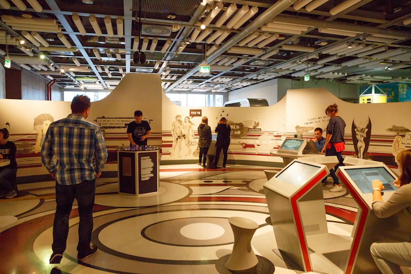
Copernicus Science Centre (Polish: Centrum Nauki Kopernik) is a science museum standing on the bank of the Vistula River in Warsaw, Poland. It contains over 450 interactive exhibits that enable visitors to single-handedly carry out experiments and discover the laws of science for themselves. The centre is the largest institution of its type in Poland and one of the most advanced in Europe. In 2018, since its opening, it has been visited by over 8 million people.
The first module of the Centre building was opened on 5 November 2010 with five galleries (On the move, Humans and the environment, Roots of civilization, Lightzone, Bzzz!); the exhibit for teenagers – RE: generation was opened 3 March 2011; a planetarium The Heavens of Copernicus opened on 19 June, the Discovery Park on 15 July, chemistry laboratory – 18 October; biology laboratory – 15 November, robotics workshop – 6 December, and physics laboratory – 20 December.
Copernicus, who lived from 1473 to 1543, is one of the most famous scientists and mathematicians to come out of Poland. It was he who formulated the theory that the earth revolves around the sun, and not the other way around.
It is fitting, therefore, that Poland honors him with the Copernicus Science Centre, with a planetarium exhibit devoted to space and how it impacts our lives. Travelers fluent in Polish may want to attend a lecture by one of Poland’s key scientists. Poland’s top science museum also offers hands-on experiments for budding scientists of all ages.
3.Palace of Culture and Science
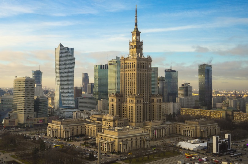
The Palace of Culture and Science is a notable high-rise building in central Warsaw, Poland. With a total height of 237 metres (778 ft), it is the second tallest building in both Warsaw and Poland (after the Varso Tower), the sixth tallest building in the European Union and one of the tallest in Europe. At the time of its completion in 1955, the Palace was the eighth tallest building in the world, retaining the position until 1961; it was also briefly the tallest clock tower in the world, from 2000 until the 2002 installation of a clock mechanism on the NTT Docomo Yoyogi Building in Tokyo, Japan.
Motivated by Polish historical architecture and American art deco high-rise buildings, the Palace of Culture and Science was designed by Soviet-Russian architect Lev Rudnev in “Seven Sisters” style and is informally referred to as the Eighth Sister.
The Palace of Culture and Science is a multi-functional building that houses everything from companies to entertainment venues. Built in the 1950s, the high-rise building – the tallest in Poland — features a spire that reaches into the sky. It was originally named for Joseph Stalin, but changed when the Soviet leader fell out of favor.
The building is sometimes referred to as Beijing, because its initials are PKIN, after the Chinese’s capital’s old name, Peking. As a concert venue, it’s hosted many international groups, including the Rolling Stones back in 1967. The Palace of Culture and Science is one of Warsaw’s top landmarks.
4.Wilanow Palace
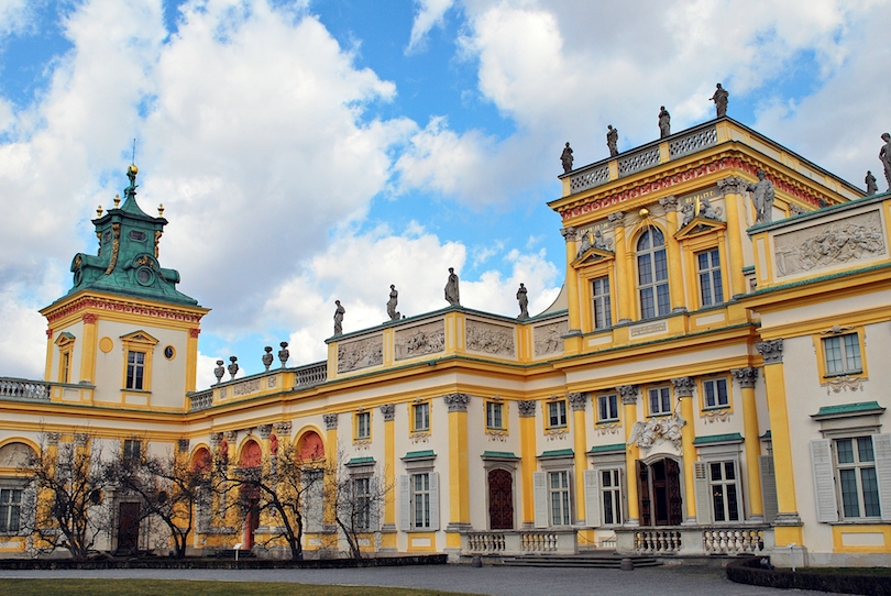
Pałac w Wilanowie – barokowy pałac królewski znajdujący się w Warszawie, w dzielnicy Wilanów. Został wzniesiony w latach 1681–1696 dla króla Jana III Sobieskiego i Marii Kazimiery według projektu Augustyna Wincentego Locciego; skrzydła boczne dobudowano w latach 1723–1729. Siedziba Muzeum Pałacu Króla Jana III w Wilanowie.
Pałac wraz z otaczającym parkiem oraz zabudowaniami zachował niezmienioną formę architektoniczną, walory historyczne i artystyczne. W 1994 wilanowski zespół pałacowy wraz z Morysinem został uznany za pomnik historii. Jest on miejscem wydarzeń kulturalnych, koncertów i spotkań. Obok pałacu znajduje się ogród.
Wilanow Palace is one of the most important monuments in Poland, representing what Poland was like before the 18th century. The palace was built as a home for King John III Sobieski. After his death the palace was owned by private families, each one changing the way the palace looked.
Unlike the rest of Warsaw, the royal palace survived WWII almost unscathed, and most of its furnishings and art were reinstalled after the war. Today, it is a museum that is home to the country’s artistic and royal heritage. The 17th century royal palace hosts several music festivals, including the summer concerts in the garden.
5.Warsaw Uprising Museum

The Warsaw Rising Museum (Polish: Muzeum Powstania Warszawskiego), in the Wola district of Warsaw, Poland, is dedicated to the Warsaw Uprising of 1944. The institution of the museum was established in 1983, but no construction work took place for many years. It opened on July 31, 2004, marking the 60th anniversary of the uprising.
The museum sponsors research into the history of the uprising, and the history and possessions of the Polish Underground State. It collects and maintains hundreds of artifacts – ranging from weapons used by the insurgents to love letters – to present a full picture of the people involved. The museum’s stated goals include
the creation of an archive of historical information on the uprising and the recording of the stories and memories of living participants. Its director is Jan Ołdakowski, with historian Dariusz Gawin from the Polish Academy of Sciences as his deputy.
The museum is a member organisation of the Platform of European Memory and Conscience.
Warsaw was famous for withstanding the Nazis during World War II. The Jewish ghetto, where Jews were confined by the Nazis, was the largest in Europe. The uprising, however, was not limited to Jews alone. Indeed, the whole city joined the fight in 1944.
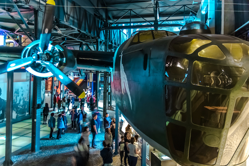
The Warsaw Uprising Museum opened in 2004 on the 60th anniversary of the uprising. Visitors will find a day-by-day account of the uprising which began on August 1 and ended on October 2. They’ll also find an exhibit dedicated to children who participated in the uprising; a replica of the sewers the insurgents used to get around, and an observation tower with great views of Warsaw.
6.Royal Castle
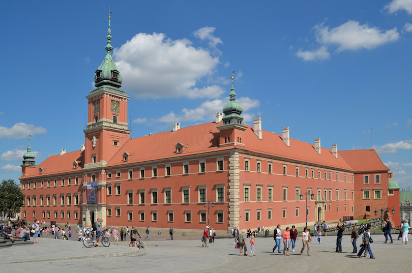
The Royal Castle in Warsaw (Polish: Zamek Królewski w Warszawie) is a state museum and a national historical monument, which formerly served as the official royal residence of several Polish monarchs. The personal offices of the king and the administrative offices of the royal court were located in the Castle from the 16th century until the final partition of Poland in 1795. Situated in the Castle Square, at the entrance to the Warsaw Old Town, the Royal Castle holds a significant collection of Polish and European art.
The Royal Castle witnessed many notable events in Poland’s history; the Constitution of 3 May 1791, first of its type in Europe and the world’s second-oldest codified national constitution, was drafted here by the Four-Year Parliament.[2] The edifice was redesigned into a neoclassical style following the partitions of Poland. Under the Second Polish Republic (1918–1939), it was the seat of the Polish head of state and president. The Second World War brought complete destruction to the building; in September 1939 it was targeted and ignited by Luftwaffe fighter aircraft, and then detonated by the Nazis after the failed Warsaw Uprising in 1944.
The Royal Castle served as the home and officials of Polish rulers for centuries. It is located on Castle Square at the entrance to Old Town. The castle dates back to the 14th century when it was the official residence of the Dukes of Masovia.
It was conquered many times by invaders from afar, but bounced back to be the place where the first constitution in Europe was drafted in 1791. This impressive structure, with a tower in the middle, is a museum today, though official state meetings are sometimes held here. The castle’s design was the inspiration of many other Warsaw buildings.
7.Lazienki Park
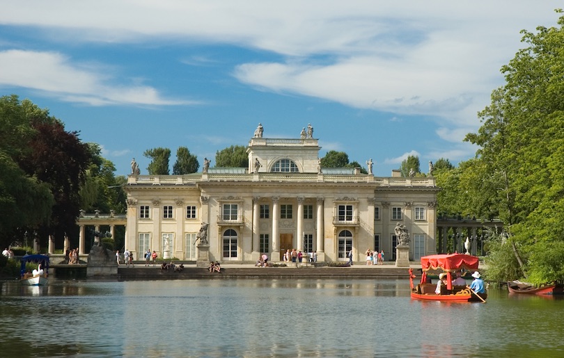
Łazienki Park or Royal Baths Park (Polish: Park Łazienkowski, Łazienki Królewskie) is the largest park in Warsaw, Poland, occupying 76 hectares of the city center.
The park-and-palace complex lies in Warsaw’s central district (Śródmieście) on Ujazdów Avenue, which is part of the Royal Route linking the Royal Castle with Wilanów Palace to the south. North of Łazienki Park, on the other side of Agrykola Street, stands Ujazdów Castle.
Originally designed in the 17th century as a baths park for nobleman Stanisław Herakliusz Lubomirski, in the 18th century Łazienki was transformed by Poland’s last monarch, Stanislaus II Augustus, into a setting for palaces, villas, classicist follies, and monuments. In 1918 it was officially designated a public park.
Łazienki is visited by tourists from all over Poland and the world, and serves as a venue for music, the arts, and culture. The park is also home to peacocks and a large number of squirrels.
Lazienki Park, also known as Royal Baths Park, is the largest park in Warsaw. Designed as a park in the 17th century, it eventually was turned into a place for villas, monuments and palaces.
The Palace on the Isle is the foremost building in the park, located on the Royal Route in central Warsaw. This palace today is a treasure trove of paintings collected by Polish royalty and statues of the country’s greatest rulers.
Also located on the isle is a Greco-Roman amphitheatre that dates back to 1793. More palaces and an 18th century orangery can be found in the park.
by Best-Mag Magazine Editorial | Travel
Bologna Emilian: Bulåggna is a city in and the capital of the Emilia-Romagna region in Northern Italy, of which it is also its largest. It is the seventh most populous city in Italy, with about 400,000 inhabitants and 150 different nationalities.Its metropolitan area is home to more than 1,000,000 people. It is known as the Fat City for its rich cuisine, and the Red City for its red tiled rooftops and, more recently, its leftist politics. It is also called the Learned City because it is home to the oldest university in the world.
Originally Etruscan, the city has been an important urban center for centuries, first under the Etruscans (who called it Felsina), then under the Celts as Bona, later under the Romans (Bonōnia), then again in the Middle Ages, as a free municipality and later signoria, when it was among the largest European cities by population. Famous for its towers, churches and lengthy porticoes, Bologna has a well-preserved historical centre, thanks to a careful restoration and conservation policy which began at the end of the 1970s. Home to the oldest university in continuous operation, the University of Bologna, established in AD 1088, the city has a large student population that gives it a cosmopolitan character. In 2000, it was declared European capital of culture and in 2006, a UNESCO “City of Music” and became part of the Creative Cities Network. In 2021, UNESCO recognized the lengthy porticoes of the city as a World Heritage Site.
1.Piazza Maggiore
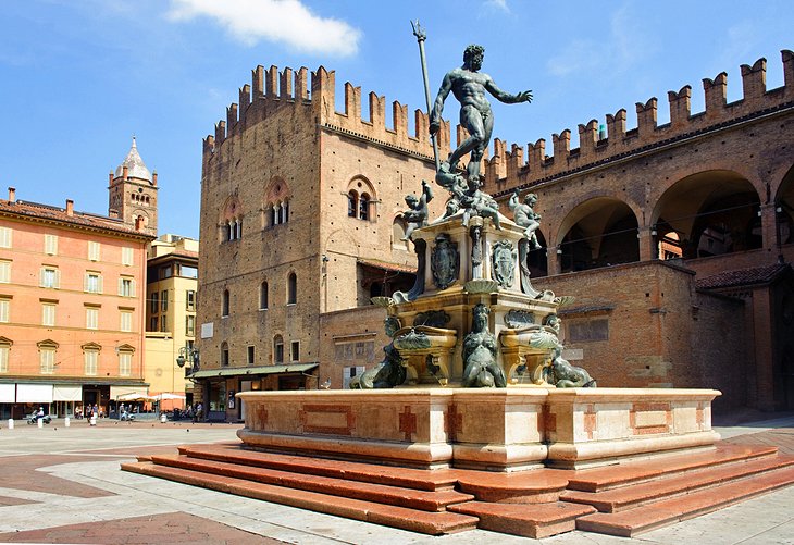
Piazza Maggiore (Piâza Mażåur in the Bolognese language) is a central square in Bologna, region of Emilia-Romagna, Italy. The appearance in the 21st century, generally reflects the layout from the 15th century. The Northwest corner opens into Piazza del Nettuno with its Fontana del Nettuno, while the Northeast corner opens into the narrower Piazza Re Enzo, running along the flanks of the Palazzo Re Enzo that merges with the Palazzo del Podestà. Flanking the Piazza del Nettuno is the Biblioteca Salaborsa.
It may seem as though everyone in Bologna were meeting friends at the same time in these two adjoining squares in the heart of the city. Conversation and laughter blend with the sound of water splashing in the magnificent Neptune Fountain, which gives Piazza del Nettuno its name.
Created by Giambologna in the 16th century, it is one of the finest fountains of its period. Nearly every major attraction in the city is within a few minutes’ walk, as are the most important streets – among them the busy shopping street, Via dell’Indipendenza, and Via Galleria with its many old aristocratic mansions.
Elegantly arcaded Via dell’Archiginnasio runs alongside the great Basilica of San Petronius; its still unfinished facade dominates one side of Piazza Maggiore. On the north side is the former Palazzo del Podestà (Governors Palace) with a tower, Torre dell’Arengo, dating from 1259. Under its vaulted dome, people whispering on one side can be heard by those on the opposite corner.
2.San Petronio (Basilica of St. Petronius)
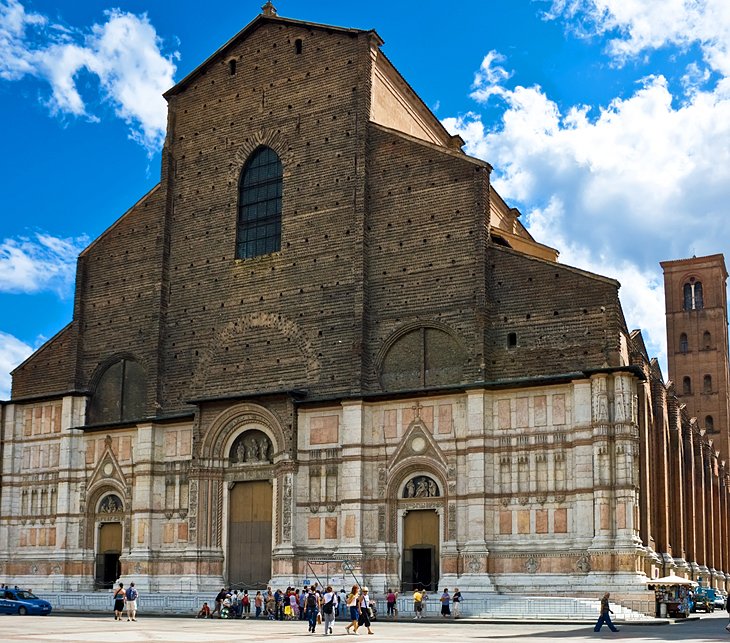
The Basilica of San Petronio is a minor basilica and church of the Archdiocese of Bologna located in Bologna, Emilia Romagna, northern Italy. It dominates Piazza Maggiore. The basilica is dedicated to the patron saint of the city, Saint Petronius, who was the bishop of Bologna in the fifth century. Construction began in 1390 and its main facade has remained unfinished since. The building was transferred from the city to the diocese in 1929; the basilica was finally consecrated in 1954. It has been the seat of the relics of Bologna’s patron saint only since 2000; until then they were preserved in the Santo Stefano church of Bologna.
When construction of the massive church that dominates one side of Piazza Maggiore began in 1390, it was designed to be even bigger than St. Peter’s in Rome, but never quite made it. In fact, it was never finished, and the facade remains incomplete. In the tiny museum at the back of the church, you can see the designs that were submitted for the facade, including those by the great architect Andrea Palladio.
The interior, which was finished, is often referred to as the epitome of Gothic architecture in Italy, and each of the side chapels seems like a small church. Look for the strange line cutting across the floor of the nave; it is a meridian line.
3.Santo Stefano (St. Stephen Basilica)
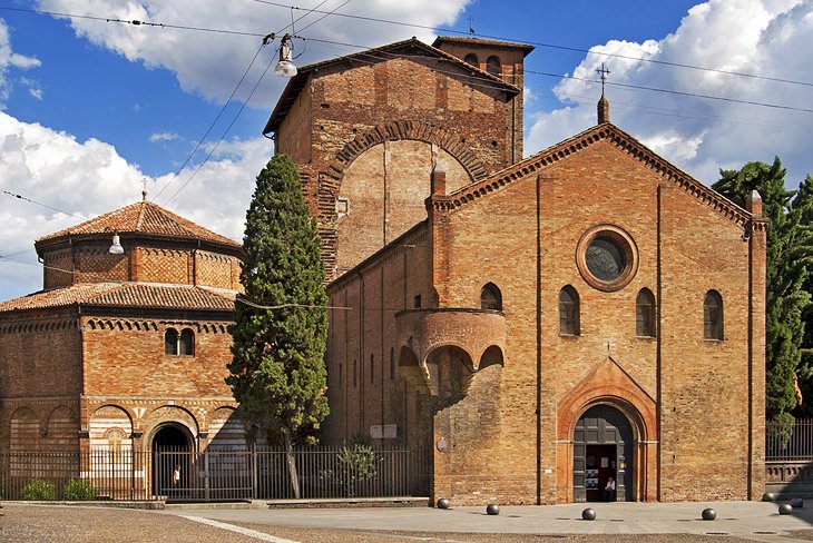
The basilica of Santo Stefano (Italian: Basilica di Santo Stefano) encompasses a complex of religious edifices in the city of Bologna, Italy. Located on Piazza Santo Stefano, it is locally known as Sette Chiese (“Seven Churches”) and Santa Gerusalemme(“Holy Jerusalem”). It has the dignity of minor basilica.
According to tradition Saint Petronius, a bishop of the city during the 5th century, built the basilica over a temple of the goddess Isis. The saint wished to have a building that recalled the Church of the Holy Sepulchre in Jerusalem.
The different parts of the complex include:
Church of Saint Stephen or of the Holy Crucifix (8th century, presbytery reshaped in 17th century), with the Crypt
Church of the Holy Sepulchre (according to tradition: 5th century)
Church of the Saints Vitale and Agricola (4th century, rebuilt first in the 12th century)
Courtyard of Pilate (“Santo Giardino”, 13th century)
Church of the Trinity or of the Martyrium (13th century)
Chapel of the Bandage (“Cappella della Benda”) dedicated to the strip of cloth worn around the head by the Virgin Mary as a sign of mourning.
While Bologna has no shortage of interesting and art-filled churches, Santo Stefano is the oldest and the most atmospheric. The complex of eight buildings could be called the cradle of faith in Bologna, built by the Benedictines between the 10th and 13th centuries to house the remains of Bologna’s early martyrs, Saints Vitale and Agricola.
Chiesa del Crocifisso, the principal church, has a 12th-century external pulpit and a crypt dating to 1019; octagonal Santo Sepolcro opens onto a pillared courtyard adjoining a two-story cloister. In the simple third church, look for the capitals of various styles recycled from previous Roman and Byzantine buildings and for the 6th-century mosaic floors.
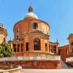
4.Sanctuary and Portico of the Madonna di San Luca

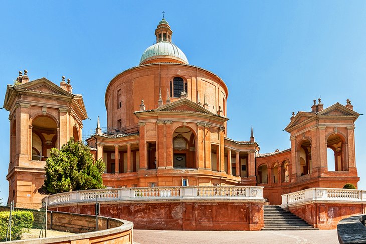
The Sanctuary of the Madonna of San Luca is a basilica church in Bologna, northern Italy, sited atop a forested hill, Colle or Monte della Guardia, some 300 metres above the city plain, just south-west of the historical centre of the city.
While a road now leads up to the sanctuary, it is also possible to reach it along a 3.8 km monumental roofed arcade (Portico di San Luca) consisting of 666 arches, which was built in 1674–1793. It was meant to protect the icon as it was paraded up the hill. A yearly procession from the Cathedral of San Pietro in the centre of Bologna to the Sanctuary goes along this path. Originally the arches held icons or chapels erected by the patron family.
The basilica stands atop a hill that commands views across the city and the Po Valley landscape, its classical interior highlighted by the striking floor of inlaid black, white, and red marble floor. The chancel is lined in equally striking variegated black and white marble.
But what distinguishes this basilica from all the others in Italy is the 3.8-kilometer covered arcade that connects the sanctuary to the city. This monumental structure is the longest portico in the world, with 666 arches, and was built between 1674 and 1793 to protect the Byzantine Madonna with Child icon in its annual procession into Bologna. The icon, said to have been painted by Saint Luke, has traveled this route to Bologna’s Cathedral of San Pietro since 1433, when it was brought from a hilltop convent in the hope of a miracle to stop harvest-threatening rains.
5.Enjoy Bolognese Food

Perhaps Bologna’s greatest appeal to tourists, and the source of its fame throughout Italy, is its reputation as a culinary center. It’s known for tortellini, tagliatelle, and other pastas, and its classic dish, tagliatelle al ragu, is known elsewhere simply as tagliatelle Bolognese. Cured meats are a local specialty, and this region is the home of the incomparable Parmigiano Reggiano cheese.
You can experience and savor Bologna’s culinary heritage. A good place to begin is in its markets and food shops. The narrow streets of the Quadrilatero, an area between Piazza Maggiore, via Rizzoli, via Castiglione, and via Farini, has been a market since Roman times, filled with little shops and outdoor stands selling all kinds of food, from garden produce, cheese, and fish to freshly made pastas and baked goods.
Opportunities to learn from Bolognese chefs and home cooks abound, from group classes to individual lessons on forming perfect tortellini. Another thing to do is join a specialized tour led by a local foodie. These will likely include visits to food markets and a number of traditional food shops, including a bakery, chocolatier, salumeria (deli), pasta maker, and gelato shop where you can sample some of Bologna’s specialties.
6.Bologna’s Portici
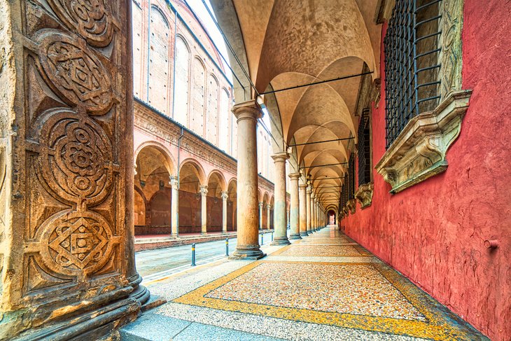
The Porticoes of Bologna are an important cultural and architectural heritage of Bologna, Italy and represent a symbol of the city together with the numerous towers.No other city in the world has as many porticoes as Bologna: all together, they cover more than 38 kilometres (24 mi) only in the historic centre, but can reach up to 53 kilometres (33 mi) if those outside the medieval city walls are also considered.
On account of their cultural and artistic significance, in 2021 the porticoes of Bologna have been declared a UNESCO World Heritage Site.
Visitors to Bologna can’t help strolling under the portici, the arcades that line so many of its streets. They are a welcome relief from the summer sun and shelter from the rain, as well as providing extra space to shops, which often display goods under them.
They began in the 11th century as overhanging upper stories of buildings in the growing city center, adding more living and storage space over the shops and businesses on the street level. As they became larger, they needed support beams and posts, and gradually the arcades grew. In the 13th century, new arcades were required to be tall enough for a rider to pass through on horseback, a rule that led to the elegant arched arcades we see today.
7.San Domenico (St. Dominic Church)
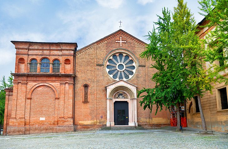
The Basilica of San Domenico is one of the major churches in Bologna, Italy. The remains of Saint Dominic, founder of the Order of Preachers (Dominicans), are buried inside the exquisite shrine Arca di San Domenico, made by Nicola Pisano and his workshop, Arnolfo di Cambio and with later additions by Niccolò dell’Arca and the young Michelangelo.
At the death in 1221 of Saint Dominic, in this convent of the order he founded, work began on the church that took several centuries to complete. The marble tomb that enshrines his remains is reason enough to visit, carved in minute details by the greatest artists of the day, including Michelangelo and Nicola Pisano. The church’s art treasures don’t end here.
The outstanding wood inlay by intarsia master fra’ Damiano da Bergamo in the choir was hailed by Renaissance contemporaries as the eighth wonder of the world. Each first and second Saturday of the month, at 10.30am and 3.30pm, free guided tours are offered to the chapels, choir, Inquisition rooms, St. Dominic’s cell, and other places not usually open to the public.


