Washington, officially the State of Washington, is a state in the Pacific Northwest region of the Western United States.Washington is the 18th-largest state, with an area of 71,362 square miles (184,830 km2), and the 13th-most populous state, with more than 7.7 million people. The majority of Washington’s residents live in the Seattle metropolitan area, the center of transportation, business, and industry on Puget Sound, an inlet of the Pacific Ocean consisting of numerous islands, deep fjords, and bays carved out by glaciers. The remainder of the state consists of deep temperate rainforests in the west; mountain ranges in the west, central, northeast, and far southeast; and a semi-arid basin region in the east, central, and south, given over to intensive agriculture. Washington is the second most populous state on the West Coast and in the Western United States, after California. Mount Rainier, an active stratovolcano, is the state’s highest elevation at 14,411 feet (4,392 meters), and is the most topographically prominent mountain in the contiguous U.S.
1.Seattle Center and the Space Needle
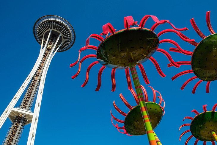
The architecture of the Space Needle is the result of a compromise between the designs of two people, Edward E. Carlson and John Graham, Jr. The two leading ideas for the World Fair involved businessman Edward E. Carlson’s sketch (on a napkin) of a giant balloon tethered to the ground (the gently sloping base) and architect John Graham’s concept of a flying saucer (the halo that houses the restaurant and observation deck). Victor Steinbrueck introduced the hourglass profile of the tower. The Space Needle was built to withstand wind speeds of 200 mph (320 km/h), double the requirements in the building code of 1962. The 6.8 Mw Nisqually earthquake jolted the Needle enough in 2001 for water to slosh out of the toilets in the restrooms. The Space Needle will not sustain serious structural damage during earthquakes of magnitudes below 9.1. Also made to withstand Category 5 hurricane-force winds, the Space Needle sways only 1 in (25 mm) per 10 mph (16 km/h) of wind speed.
For decades, the hovering disk of the Space Needle was home to two restaurants 500 ft (150 m) above the ground: the Space Needle Restaurant, which was originally named Eye of the Needle, and Emerald Suite. These were closed in 2000 to make way for SkyCity, a larger restaurant that features Pacific Northwest cuisine. In 1993, the elevators were replaced with new computerized versions. The new elevators descend at a rate of 10 mph (16 km/h).
2.Olympic National Park
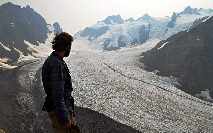
Olympic National Park is on Washington’s Olympic Peninsula in the Pacific Northwest. The park sprawls across several different ecosystems, from the dramatic peaks of the Olympic Mountains to old-growth forests. The summit of glacier-clad Mt. Olympus is popular with climbers, and hiking and backpacking trails cut through the park’s rainforests and along its Pacific coastline.
The purpose of Olympic National Park is to preserve for the benefit, use, and enjoyment of the people, a large wilderness park containing the finest sample of primeval forest of Sitka spruce, western hemlock, Douglas fir, and western red cedar in the entire United States; to provide suitable winter range and permanent protection for the herds of native Roosevelt elk and other wildlife indigenous to the area; to conserve and render available to the people, for recreational use, this outstanding mountainous country, containing numerous glaciers and perpetual snow fields, and a portion of the surrounding verdant forests together with a narrow strip along the beautiful Washington coast.
The beach has unbroken stretches of wilderness ranging from 10 to 20 miles (16 to 32 km). While some beaches are primarily sand, others are covered with heavy rock and very large boulders. Bushy overgrowth, slippery footing, tides, and misty rainforest weather all hinder foot travel. The coastal strip is more readily accessible than the interior of the Olympics; due to the difficult terrain, very few backpackers venture beyond casual day-hiking distances.
The most popular piece of the coastal strip is the 9-mile (14 km) Ozette Loop. The Park Service runs a registration and reservation program to control the usage levels of this area. From the trailhead at Ozette Lake, a 3-mile (4.8 km) leg of the trail is a boardwalk-enhanced path through near primal coastal cedar swamp. Arriving at the ocean, it is a 3-mile walk supplemented by headland trails for high tides. This area has traditionally been favored by the Makah from Neah Bay. The third 3-mile leg is enabled by a boardwalk which has enhanced the loop’s visitor numbers.
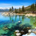
3.San Juan Islands
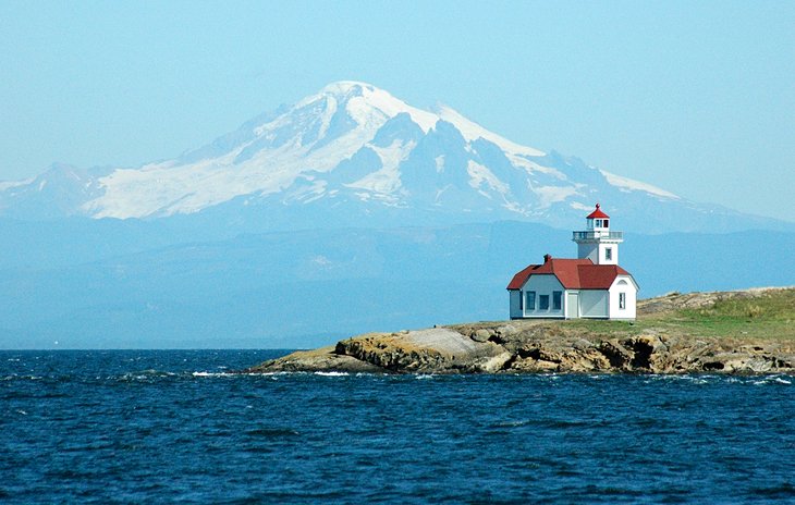
The San Juan Islands are an archipelago in the U.S. state of Washington known for rural Pacific Northwest landscapes and wildlife. Horseshoe-shaped Orcas Island, one of the main isles, is home to Moran State Park’s old-growth forest and Mt. Constitution. San Juan Island is distinguished by the lively seaside town of Friday Harbor and Lime Kiln Point State Park, an orca-whale lookout.
In the present, the San Juan Islands are an important tourist destination, with sea kayaking and orca whale-watching (by boat or air tours) being two of the primary attractions. San Juan Island’s Lime Kiln Point State Park is a prime whale-watching site, with knowledgeable interpreters often on site.
Politically, the San Juan Islands comprise, by definition, San Juan County, Washington.
At mean high tide, the archipelago comprises over 400 islands and rocks, 128 of which are named, and over 478 miles (769 km) of shoreline.
The majority of the San Juan Islands are quite hilly, with some flat areas and valleys in between, often quite fertile. The tallest peak is Mount Constitution, on Orcas Island, at an elevation of 2,407 feet (734 m). The coastlines are a mix of sandy and rocky beaches, shallow inlets and deep harbors, placid coves and reef-studded bays. Gnarled, ochre-colored madrona trees(Arbutus) grace much of the shorelines, while evergreen fir and pine forests cover large inland areas.
The San Juan Islands get substantially less rainfall than Seattle, about 65 miles (105 km) to the south, due to their location in the rain shadow of the Olympic Mountains to the southwest. Summertime high temperatures are around 70 °F (21 °C), while average wintertime lows are in the high 30s and low 40s Fahrenheit (around 5 degrees Celsius). Snow is infrequent in winter, except for the higher elevations, but the islands are subject to high winds at times; those from the northeast sometimes bring brief periods of freezing.
4.Mount Rainier National Park
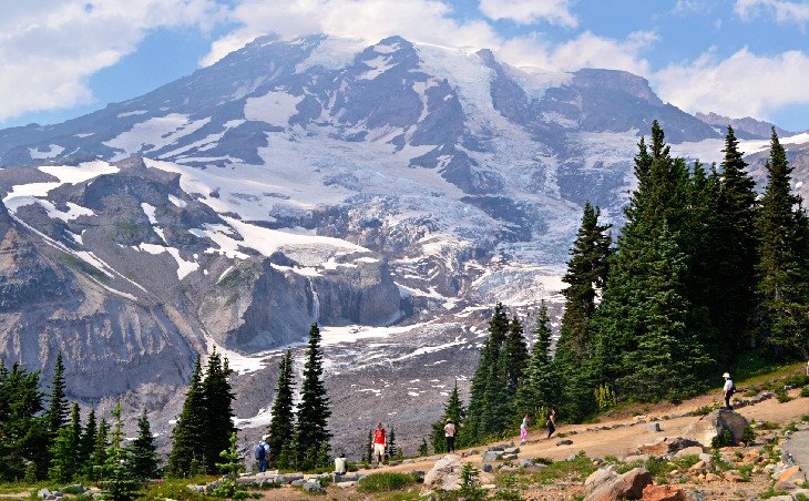
Mount Rainier National Park, a 369-sq.-mile Washington state reserve southeast of Seattle, surrounds glacier-capped, 14,410-ft. Mount Rainier. Atop 6,400-ft.-high Sunrise, the highest point in the park reachable by car, visitors can admire Rainier and other nearby volcanoes, including Mount Adams. The park’s 5,400-ft.-high Paradise overlook offers mountain views, summertime wildflower meadows and hiking trailheads.
Mount Rainier is circled by the Wonderland Trail and is covered by glaciers and snowfields totaling about 35 square miles (91 km2). Carbon Glacier is the largest glacier by volume in the contiguous United States, while Emmons Glacier is the largest glacier by area. Mount Rainier is a popular peak for mountaineering with some 10,000 attempts per year with approximately 50% making it to the summit.
The purpose of Mount Rainier National Park is to protect and preserve unimpaired the majestic icon of Mount Rainier, a glaciated volcano, along with its natural and cultural resources, values, and dynamic processes. The park provides opportunities for people to experience, understand, and care for the park environment, and also provides for wilderness experiences and sustains wilderness values.
5.Seattle Downtown
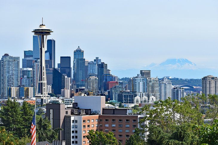
Skyscrapers overlook Elliott Bay in Seattle’s compact Downtown. Shoppers buy local crafts and produce in vibrant Pike Place Market, with its eclectic restaurants and food stalls, or hit big-name stores like Nordstrom. The busy Central Waterfront has a giant Ferris wheel and the Seattle Aquarium, while cultural attractions in the wider area include the Seattle Art Museum and the 1928 Paramount Theatre.
Belltown, Denny Triangle, the retail district, the West Edge, the financial district, the government district, Pioneer Square, Chinatown, Japantown, Little Saigon, and the western flank of First Hill west of Broadway make up downtown Seattle’s chief neighborhoods. Near the center of downtown is the Metropolitan Tract which is owned by the University of Washington; prior to 1895 it served as the location of the university’s campus. Downtown is Seattle’s financial and commercial maritime hub as well as its center of nightlife and shopping. The downtown shopping mall Westlake Center is connected to Seattle Center by a monorail.
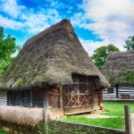
6.Leavenworth
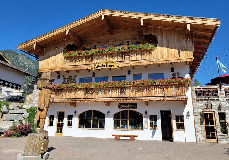
Leavenworth is a Bavarian-styled village in the Cascade Mountains, in central Washington State. Alpine-style buildings with restaurants serving German beer and food line Front Street. The Nutcracker Museum displays thousands of nutcrackers, some dating back centuries. On the Wenatchee River, Waterfront Park is a habitat for ospreys and eagles. The village is a gateway to nearby ski areas and wineries.
After the town of Leavenworth experienced the bust following a boom in the logging industry, city leaders rallied and decided to change the town’s image. Today, the town of Leavenworth proudly recognizes itself as a Bavarian Village, and it’s common to see residents wearing lederhosen or blowing a morning serenade on an alphorn.
7.Puget Sound
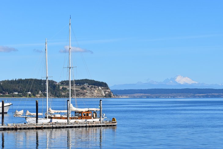
Puget Sound is a sound of the Pacific Northwest, an inlet of the Pacific Ocean, and part of the Salish Sea. It is located along the northwestern coast of the U.S. state of Washington.
The USGS defines Puget Sound as all the waters south of three entrances from the Strait of Juan de Fuca. The main entrance at Admiralty Inlet is defined as a line between Point Wilson on the Olympic Peninsula, and Point Partridge on Whidbey Island. The second entrance is at Deception Pass along a line from West Point on Whidbey Island, to Deception Island, then to Rosario Head on Fidalgo Island. The third entrance is at the south end of the Swinomish Channel, which connects Skagit Bay and Padilla Bay. Under this definition, Puget Sound includes the waters of Hood Canal, Admiralty Inlet, Possession Sound, Saratoga Passage, and others. It does not include Bellingham Bay, Padilla Bay, the waters of the San Juan Islands or anything farther north.